Early April Update from the N.C.L.

There have been a number of positive news releases in recent days, so here is a short post to tie them together and a lot of optimism for the future!

Northumberland Line
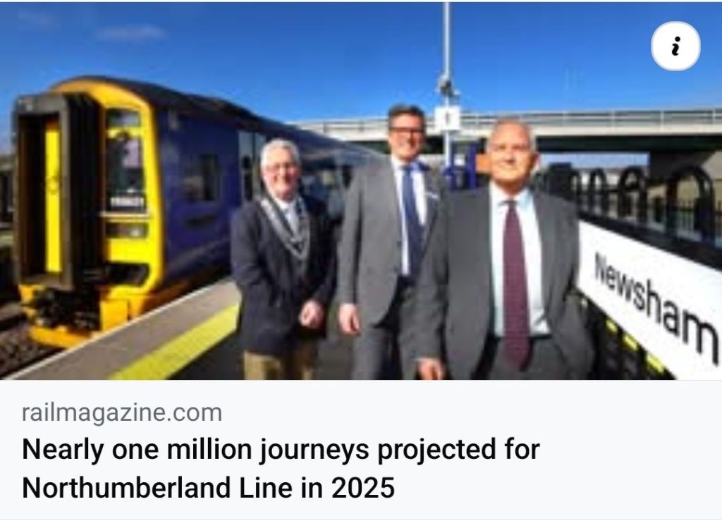
Screenshot of RAIL magazine online article (link below)

The Northumberland Line continues strong performance since opening, with a recent announcement that 250,000 trips on the route are expected by Easter 2025, just four months after opening, and an article from RAIL magazine announcing that ONE MILLION journeys are predicted by the end of 2025.

This proves that the Northumberland Line was undoubtedly the right project for SE Northumberland, and with such strong usage, will give huge credibility to expansion of system capacity where possible (which this campaign suggests could be provided by Newcastle – Bedlington – Berwick/Edinburgh trains augmenting the Northumberland Line Ashington – Newcastle services, please see our previous post on this for more).

Double Win in Alnwick

Borderline Greenway Opened!
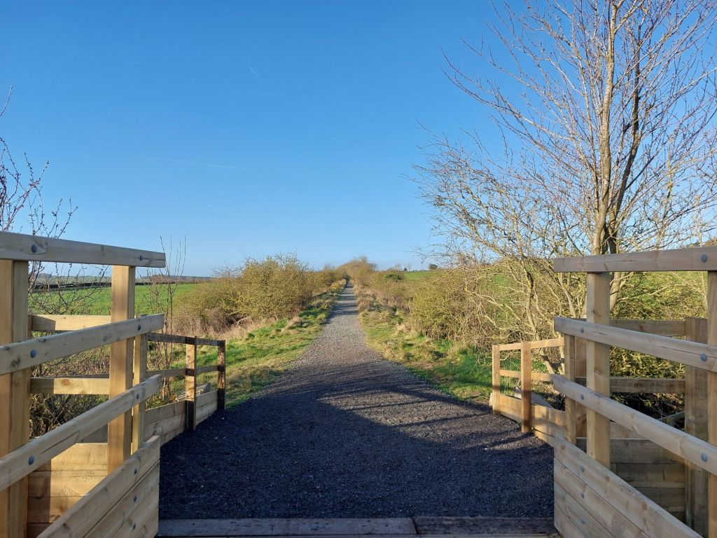
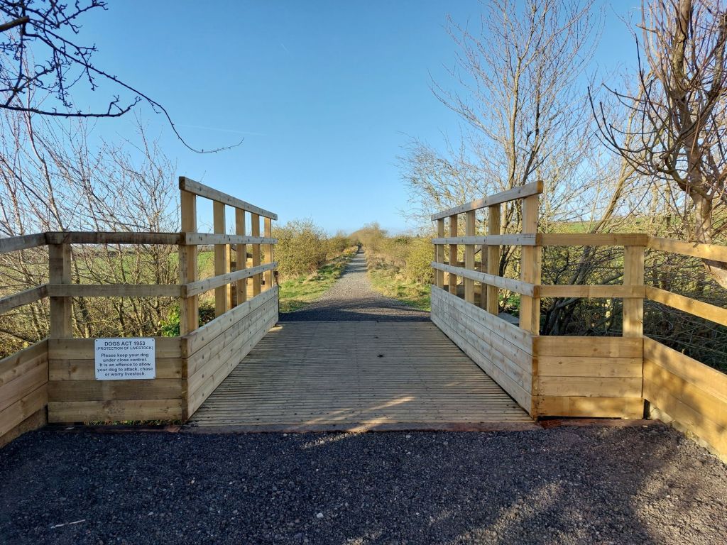
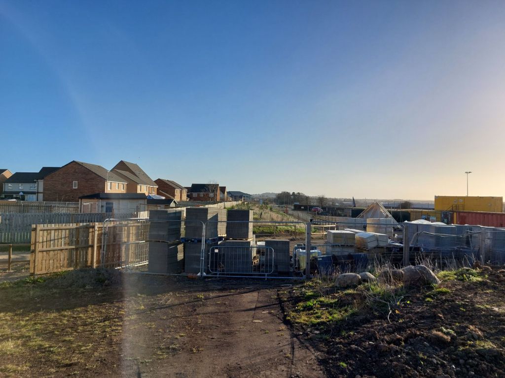
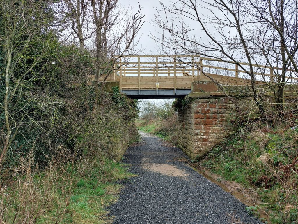
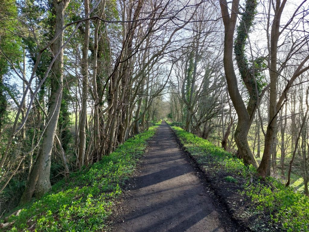
New bridge at Greensfield, the start of the Borderline Greenway on the edge of Alnwick (near to NE66 1SZ)
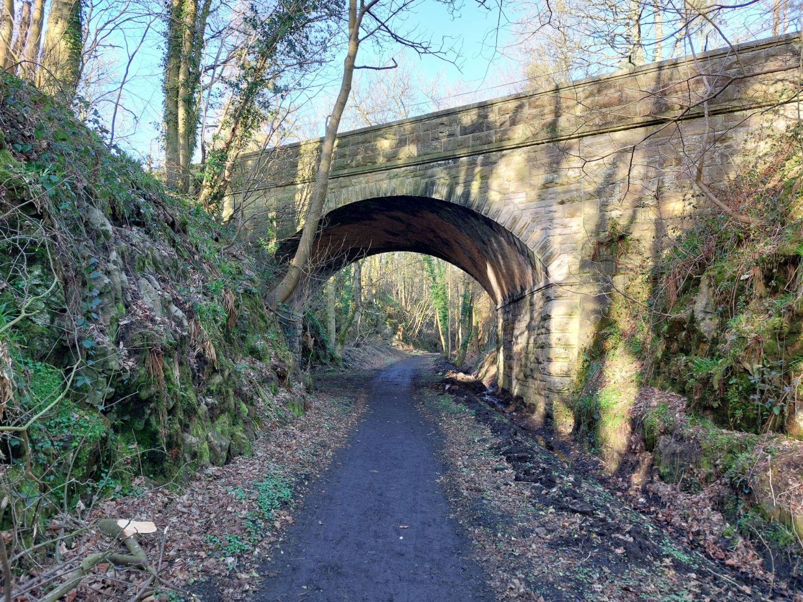
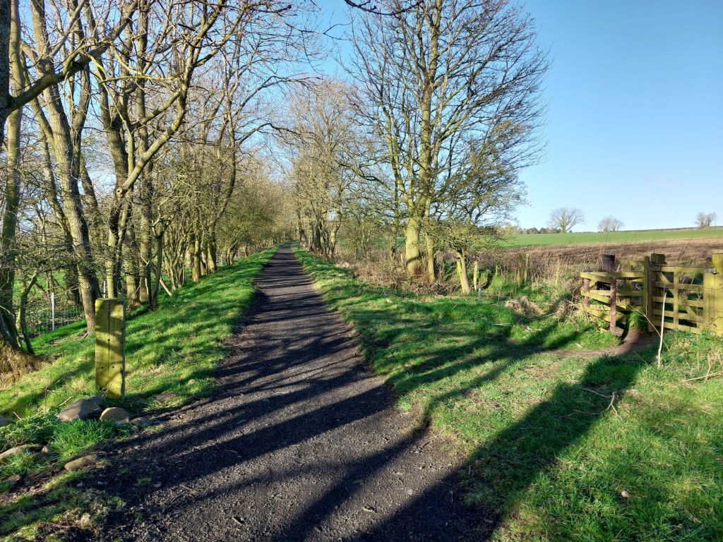
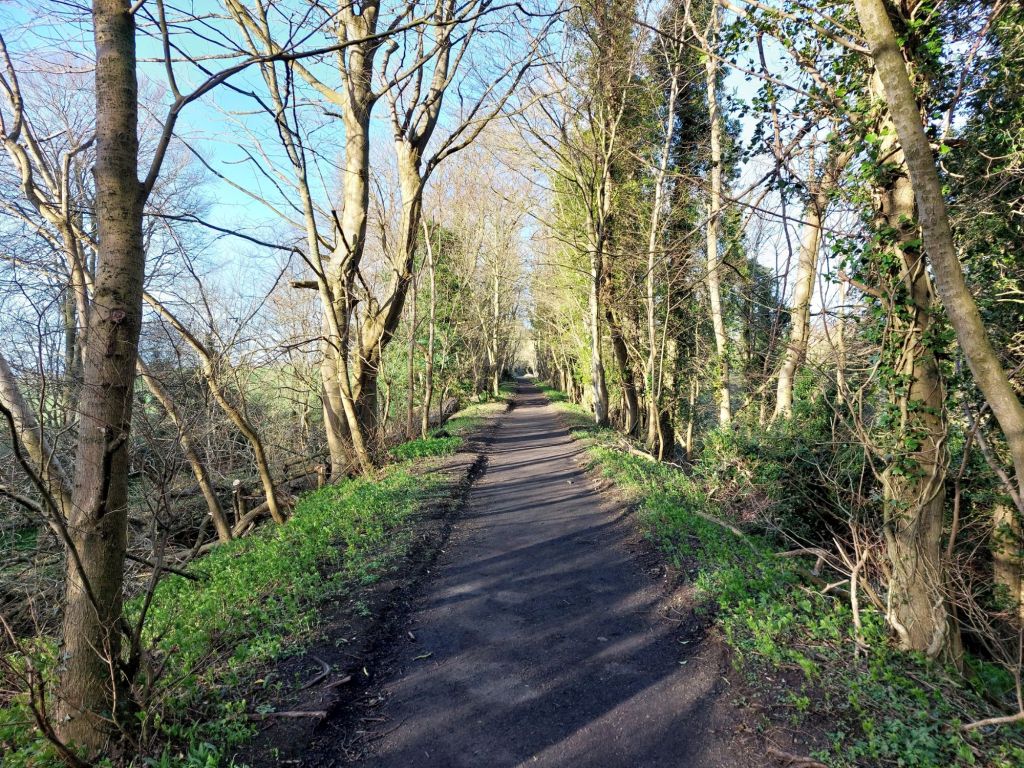
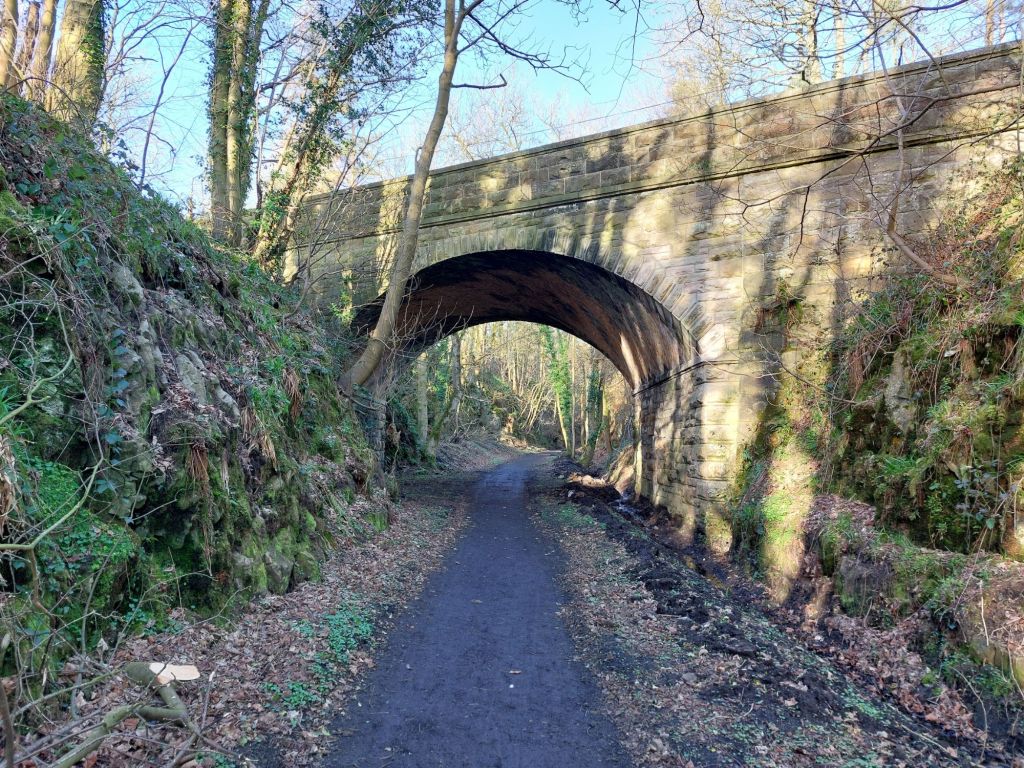
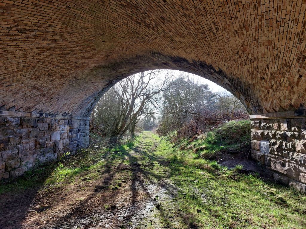
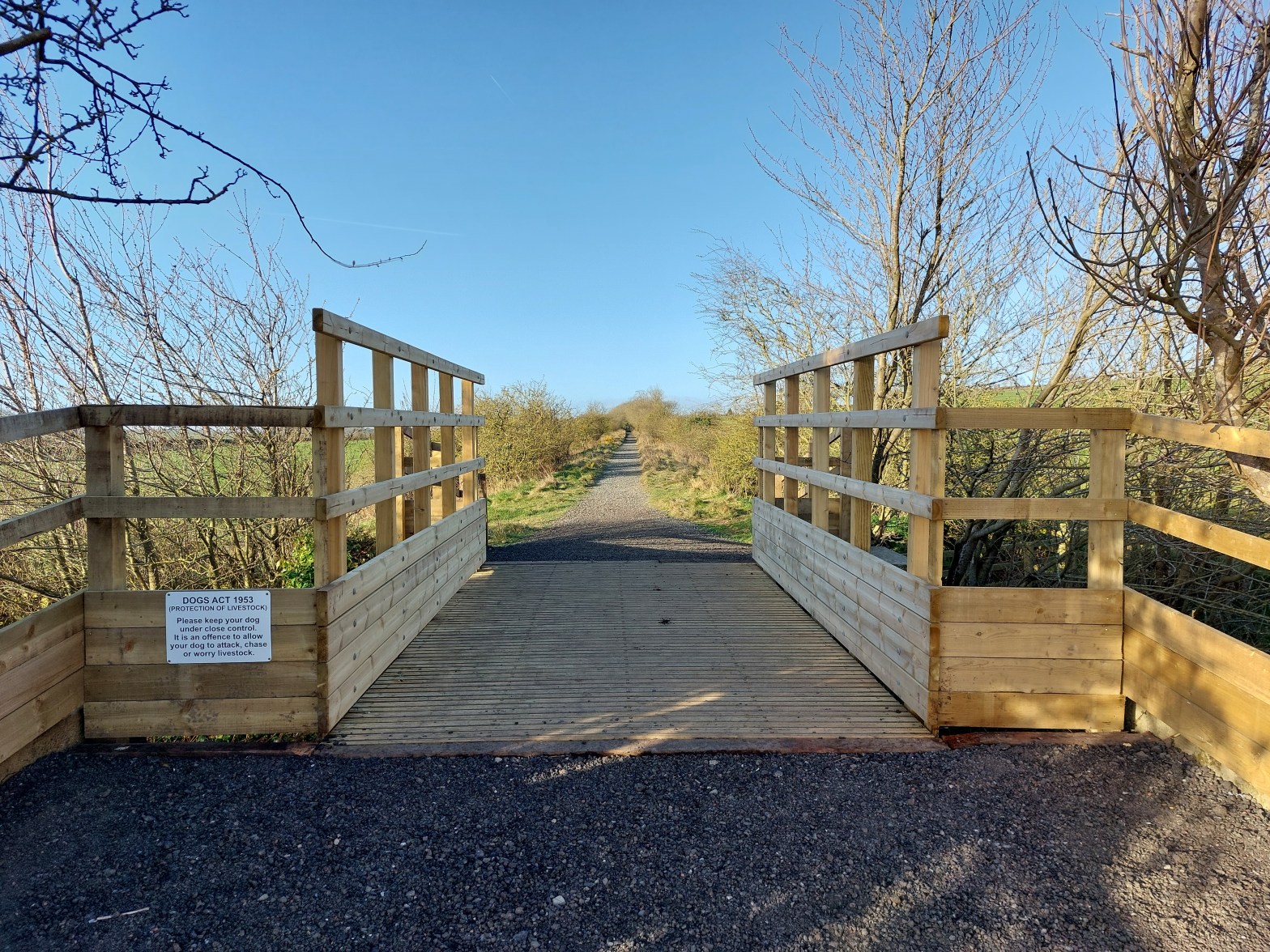
Rugley Road Bridge on the newly opened Borderline Greenway, looking towards Edlingham
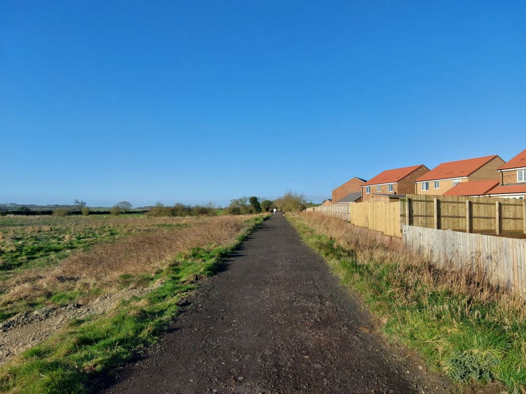
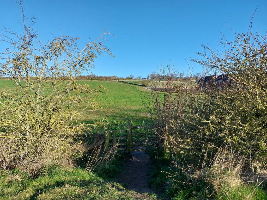
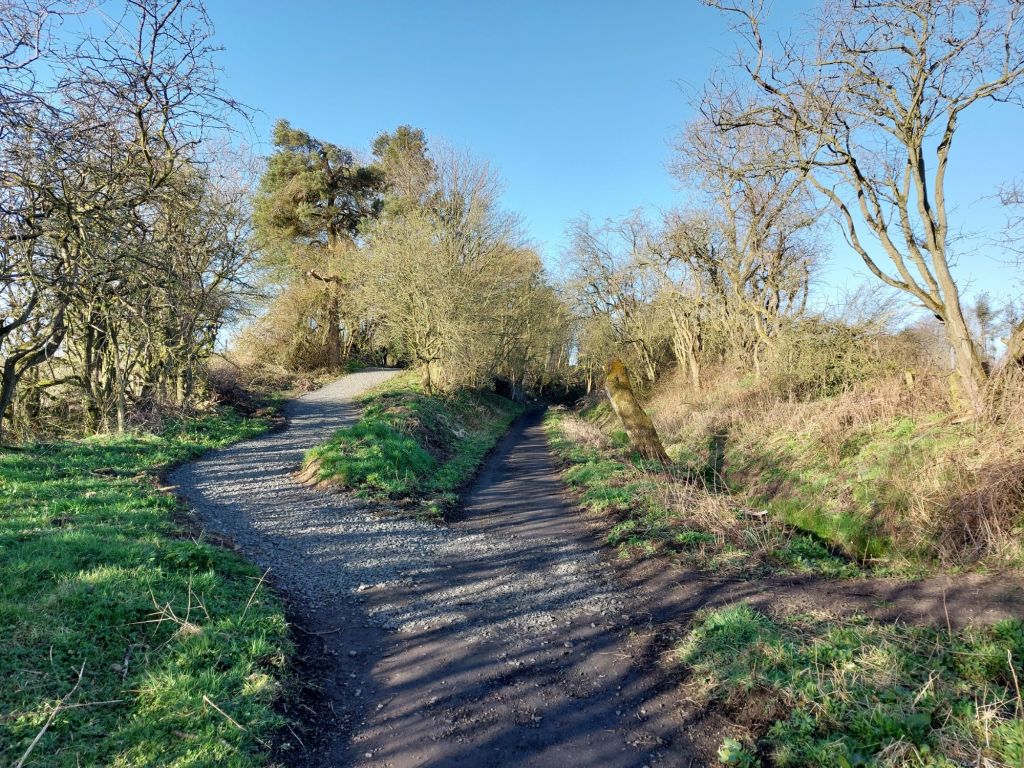
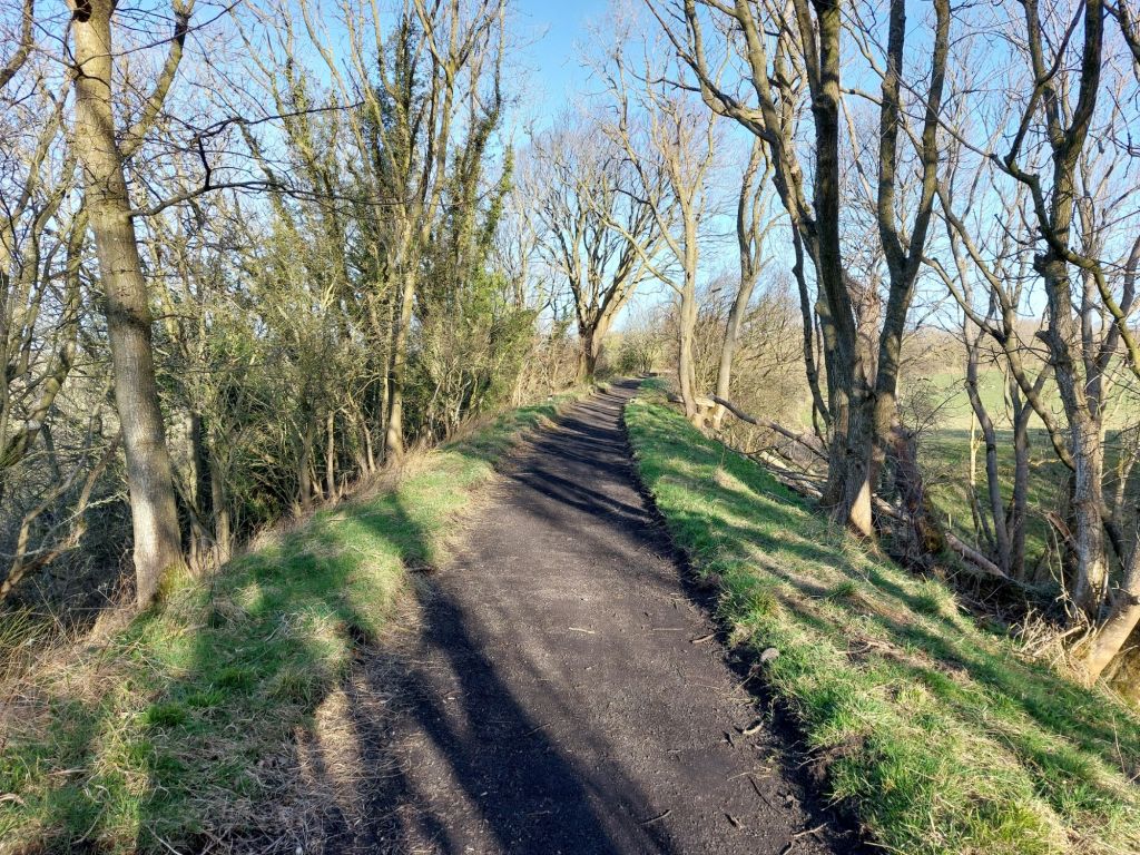
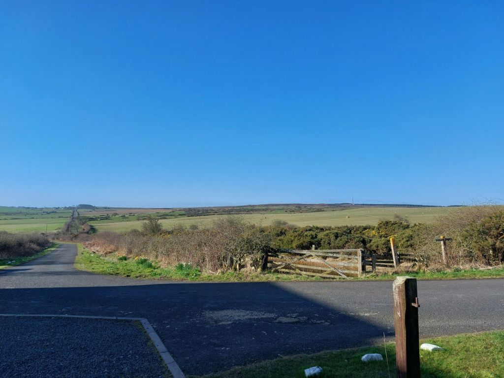
Current end of the Borderline Greenway on Alnwick Moor
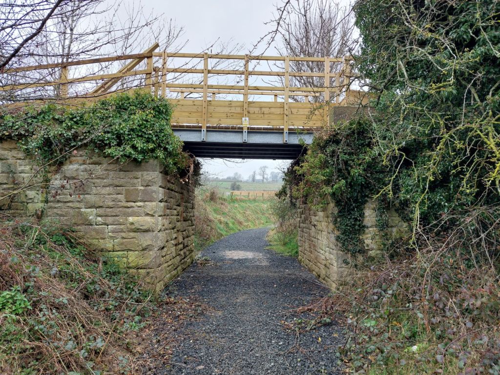
B6341 Bridge over the Alnwick and Cornhill Railway, hopefully a next phase for opening.

On Saturday the 29th March 2025, the Borderline Greenway was officially opened to the public; creating an approximately 2 mile long route utilising a section of the former Alnwick and Cornhill Railway from Greensfield on the edge of Alnwick out towards Edlingham station, the current end of the Greenway being where a change of ownership occur. 

A continuation of the route is possible at least as far as the B6341 across Alnwick Moor, allowing a large circular route to be walked, though this latter section has not yet seen the improvements that the Borderline Greenway has brought to the former trackbed via cleared drainage, vegetation cut backs and clearance of fallen trees.

Hopefully in the near future, the route beyond the B6341 will also be opened up and the realisation of the full route from Alnwick to Cornhill/Coldstream will happen.

I took a video some years ago of the route around Rugley Bridge before work was carried out, and what a transformation the current route is!

Aln Valley Railway: Stepping closer to Alnmouth Station?

In other great news recently, the Aln Valley Railway (AVR) is being assisted by Northumberland County Council (NCC) through the council’s adoption and repair of Eden Hill Bridge, which carries the U3203 over the Aln Valley Line trackbed.

This adoption means that the long standing obstacle of gaining permission to pass under the bridge can now be granted by NCC, and allow the AVR a greater chance to reach Alnmouth Station, and allow for people to once again reach the town of Alnwick by train.

The bridge required some repairs and upgrades, which is costed at around £255,000, but the benefits of reaching Alnmouth will be huge to the AVR, as well as Alnwick more generally; there could even be future potential to see railtours, and possibly even regular services to and from Alnwick (Lionheart) in the future?

Petition Progress

Both petition continue to make regular gains as time progresses, with more details below.

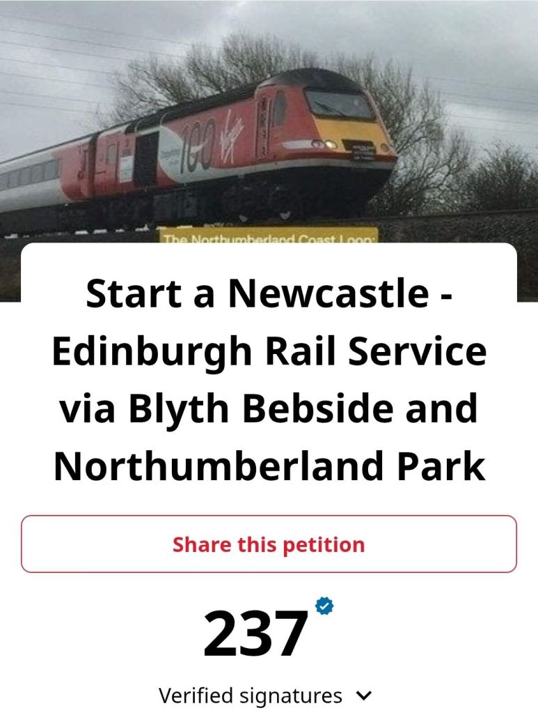
Start a Newcastle – Edinburgh Rail Service via Blyth Bebside and Northumberland Park
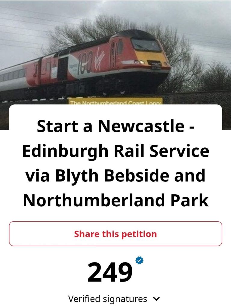
The above petition as of 4.4.25, has gained an impressive 249 signatures since its launch in February 2025. Thank you to all who have signed so far, and if you’d like to add your name, please do so via the link below:

Sign the Newcastle – Edinburgh Rail Service via Blyth Bebside and Northumberland Park Petition

As ever, please write to your MP if you live in a constituency on the route to show your support too. It’s as simple as sending an email, so if you can, please do so, the more support that this rail route gets, the sooner it can be implemented!

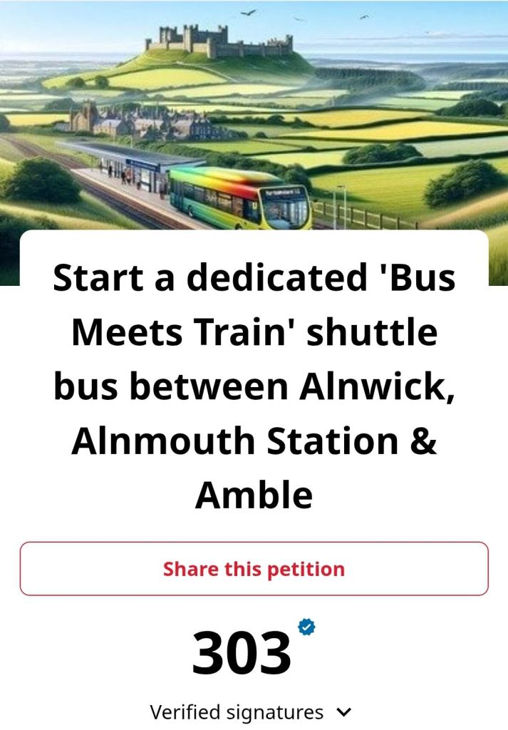
Start a dedicated ‘Bus Meets Train’ shuttle bus between Alnwick, Alnmouth Station & Amble.
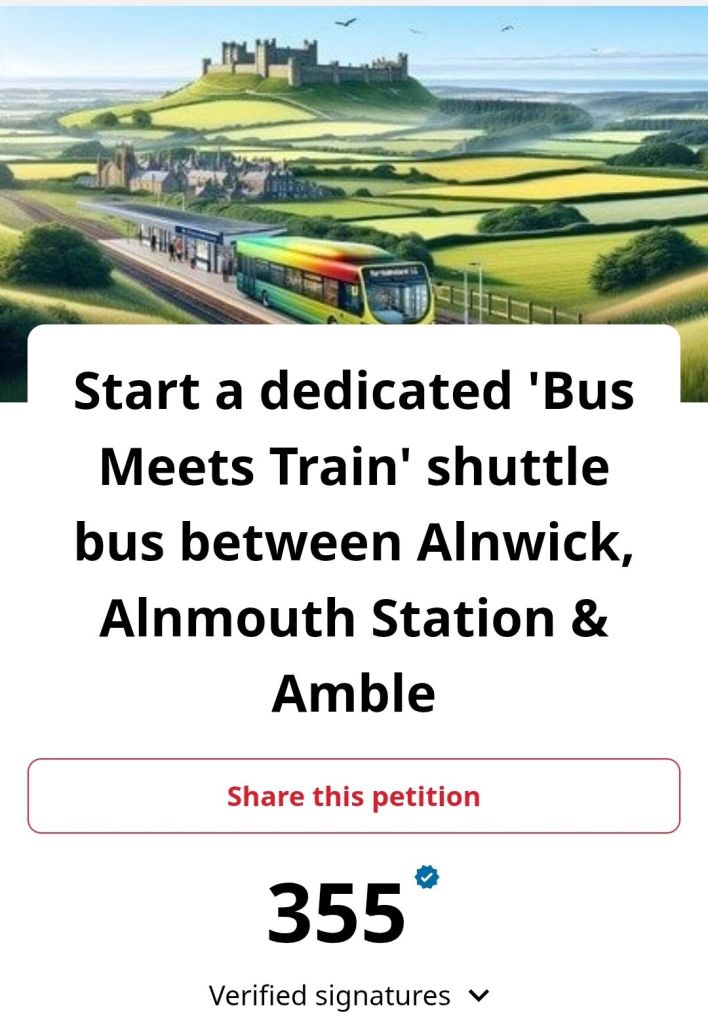
This petition has performed even more strongly, with 355 signatures since being launched in February 2025. Thank you again to all who have signed so far and of you would like to add your name, please do so via the link below!

Sign the Start a dedicated ‘Bus Meets Train’ shuttle bus between Alnwick, Alnmouth Station & Amble Petition

A dedicated bus to connect to the recently opened Borderline Greenway, as well as an expanding Aln Valley Railway, as well as thriving attractions such as Alnwick Castle, The Alnwick Garden, Lilidorei and many more surely makes a lot of sense? If you agree, please sign the petition!

Behind the Scenes

There is more work ongoing behind the scenes, please keep an eye on the blog for more information soon, especially for an important upcoming meeting!

Thanks for reading, if you’d like to support me in maintaining these campaigns, please take a look at my Ko-fi page, any support would be most welcome!  https://ko-fi.com/northumberlandcoastloop
Quick guide to the Borderline Greenway in Alnwick

The Alnwick end of the route is near to Weavers’ Court Extra Care Scheme, Swordy Drive, Alnwick NE66 1SZ; this building is home to a canny little cafe within if you’d like a tea, coffee, piece of cake, or hot food before or after your walk!

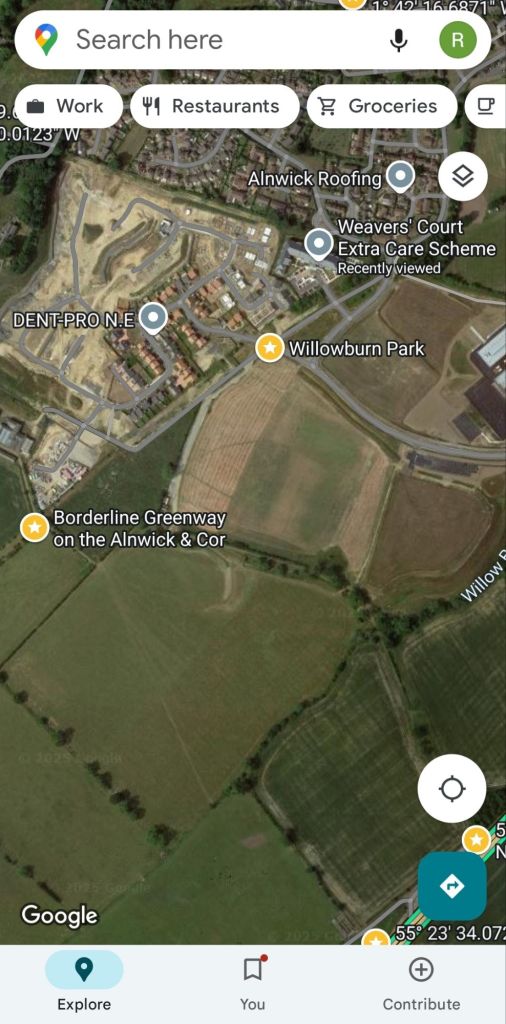
To reach the Borderline Greenway, walk along the footpath towards the yellow star called Willowburn Park, along the southern edge of The Steadings.

For an in-depth look at the route, please see our previous post here.

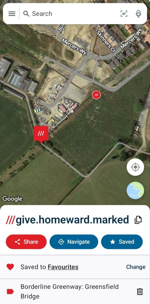
Continue on a broadly WSW direction as the map shows below (needing a little diversion south at present to go around the builder’s compound). The Borderline Greenway star is placed approximately where the new Greensfield Bridge is.

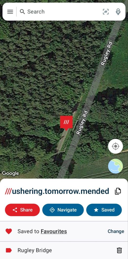
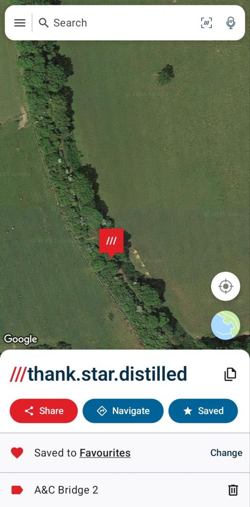
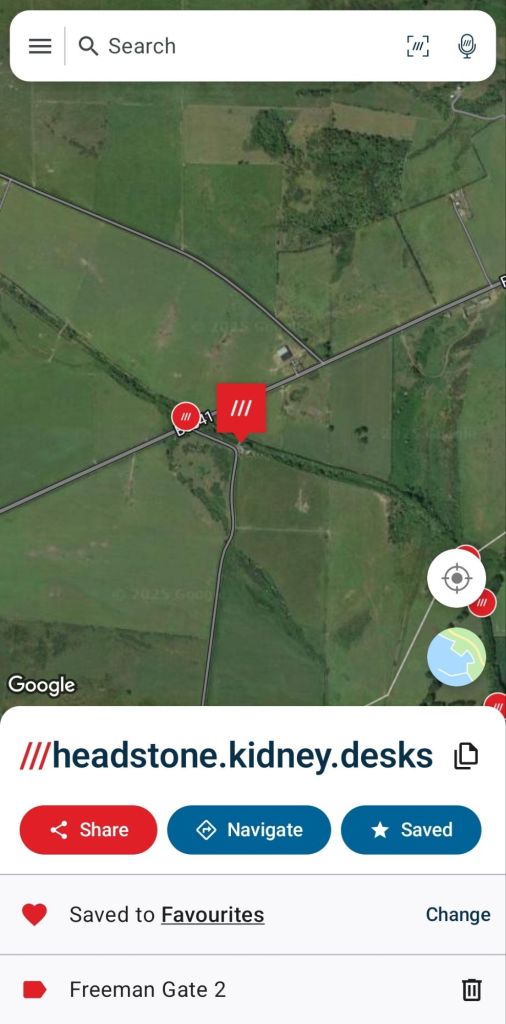
For users of what3words, this location is the site of the Greensfield Bridge

From there, the route is clear ahead and enjoy your trip along the line!

Exploring the Borderline Greenway, Alnwick 30.3.25

Yesterday (29.3.25) at 11am, the long awaited Borderline Greenway, which runs along a currently short section of the former Alnwick and Cornhill Railway finally officially opened to the public.

Click here to view The Chronicle coverage of the opening event.

The railway on this stretch opened in 1887 for traffic as a through route from Alnwick to Cornhill. In 1948, following damage from major floods, the line was divided, with an Alnwick to Ilderton section, alongside Wooler to Cornhill (Coldstream). This section,on the Alnwick side, closed in March 1953 after just a 66 year lifespan, with the Wooler section surviving until 1965.

This newly opened route starts on the edge of Alnwick near to The Steadings (Taylor Drive) housing estate, still under construction hence the building materials on part of the trackbed which hopefully will be cleared once completed, but is easily walked around via a diversionary path.

The route is in two key parts, the Borderline Greenway, improved by the Borderline Greenway CIC makes up the majority, but for the last section towards the B6341, it is owned by the Freemen of Alnwick, which as of today has not been improved, but is passable on foot with care and if able to duck and clamber over occasional obstacles.

Sturdy boots would be recommended for undertaking this walk, and a sensible off road bicycle could certainly be used on the Borderline Greenway to Rugley Bridge and to the Freemen boundary.

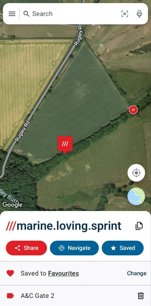
For simplicity for those following this route, what3words has been used to label key locations, but is shared alongside mapping/aerial photographs to hopefully make clear where each site is.

Looking towards Alnwick Station, with The Steadings estate on the left of the image
Towards Cornhill, The Steadings now on the right hand side.

As can be seen above, the Borderline Greenway CIC has made a great job of creating a wide, smooth path along their stretch of route, which is quite dry throughout (one small patch of water running over the path was encountered).

This walk will take in the full length of the Borderline Greenway from Taylor Drive to its end well outside of Alnwick, and then the short stretch of Freemen owned land to reach the B6341 over Alnwick Moor which formed the return leg into town.

Bridge 1

Looking towards Alnwick from Bridge 1
Towards Cornhill from Bridge 1

This bridge is the first major structure on the route, with a new deck placed in recent months (previous span had long since disappeared), and crosses another minor path below, explored some days before.

Passing below Bridge 1 some days before.
Below Bridge 1 in the opposite direction.
Path leading off the Borderline Greenway headed towards Alnwick Castle Golf Course (clubhouse just visible at top of the hill, with excellent food and drink), which is on the Rugley Road, which offers a shorter ‘loop’ to return to Alnwick if desired.

Gate 1

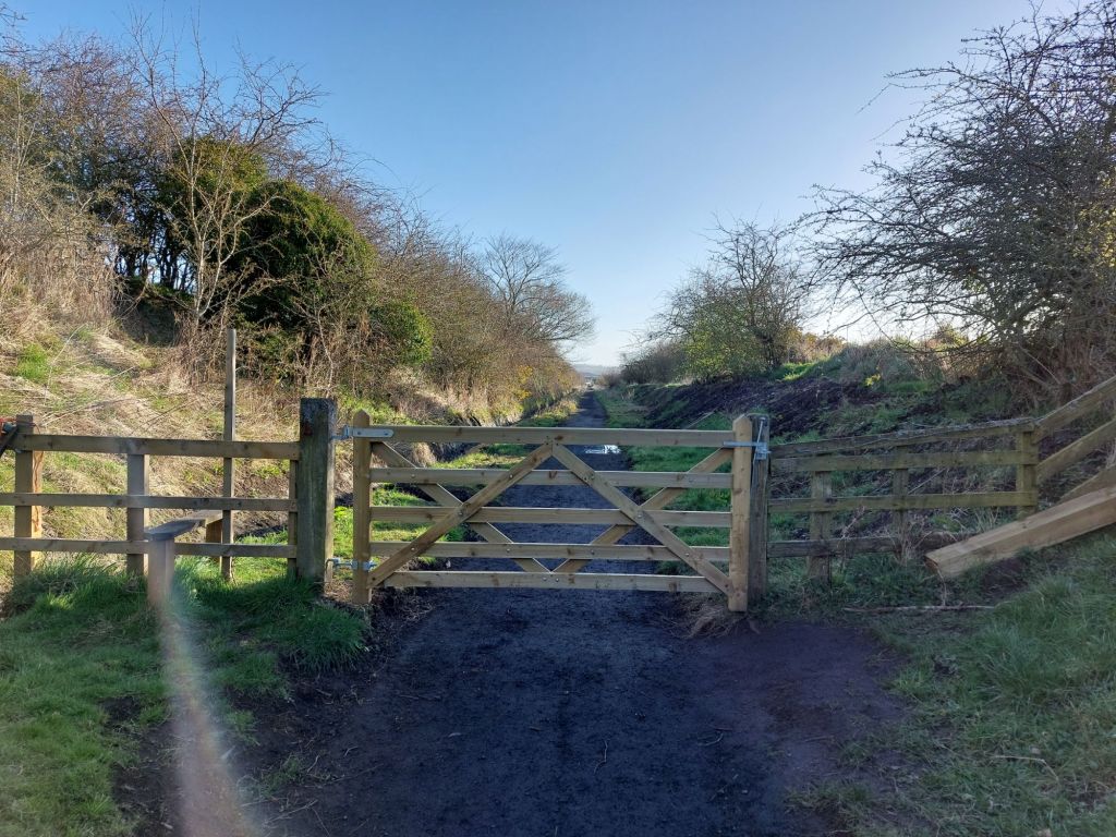
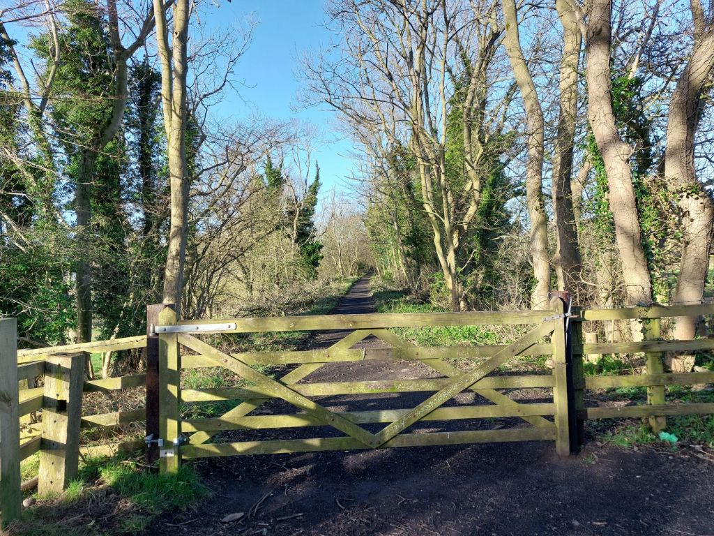
Being in a rural area where there is a possibility of livestock being around, there are a few gates across the path.

Looking at Gate 1 back towards Alnwick

What is interesting about the whole route is how much variation there is in such short distances, going from embankments, then to cuttings, from enclosed with trees to being quite open all within quick succession and makes the route very enjoyable to walk!

The Standing Sleeper

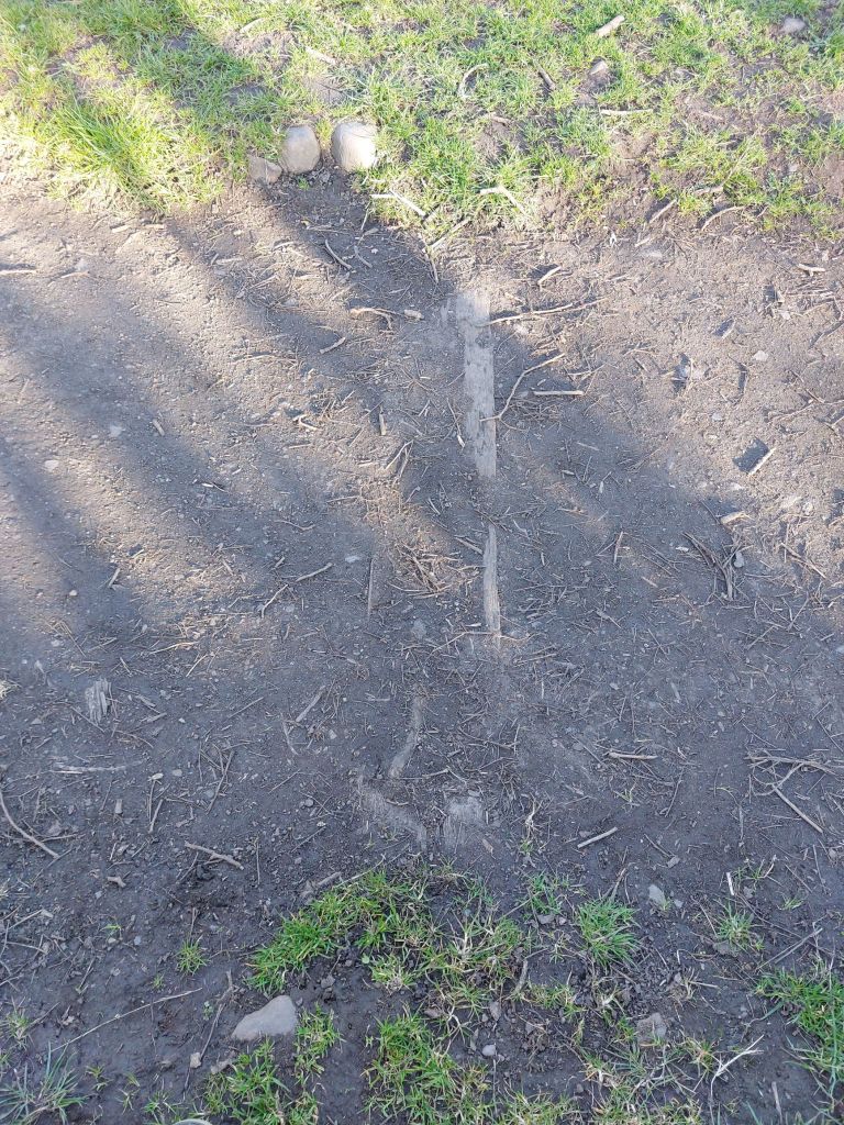
The standing sleeper (left), looking towards Cornhill

This point is one of many where other walking routes join, leave or cross the Greenway, but the single sleeper on end was a clear landmark.

Sleeper still in situ since closure in 1953?

Near this standing sleeper was the remains of another still in the ground. With the Alnwick to Ilderton section having closed to rail traffic in 1953 (well before Dr Richard Beeching), it potentially has been there for a century, perhaps even longer? 

Gate 2

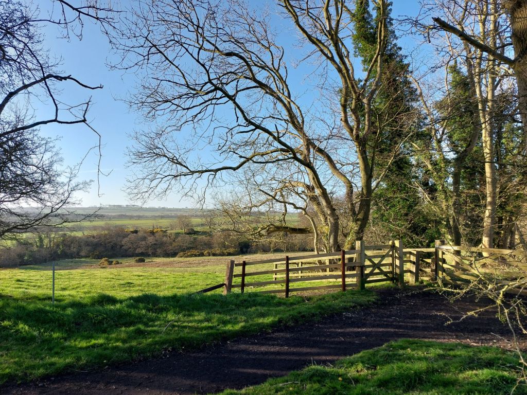
A short distance further on, another gate is encountered, and shows again the variety of scenery along the route, with wide open expanses of farmland and forest in view, and hardly a building to be seen in this area.

Rugley Burn

Here the line crossed a high, steep sided embankment over the Rugley Burn, with the minor Rugley Road jusy visible through the trees at times dropping into the valley and crossing via a ford. The scale of engineering for this line is quite remarkable for such a rural route.

Embankment over Rugley Burn looking towards Alnwick
Looking down onto the Rugley Burn
Towards Cornhill

Junction for Rugley Road

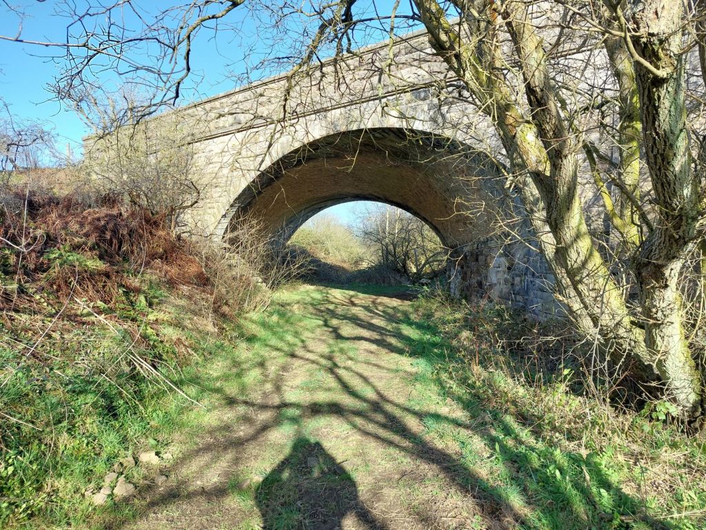
As the path approaches the minor Rugley Road, there is a very clear ‘junction’ of the paths, the left hand route, looking at the image below would take you up the cutting side to join the Rugley Road, but for us, we stay on the trackbed to pass beneath Rugley Road bridge.

Rugley Bridge

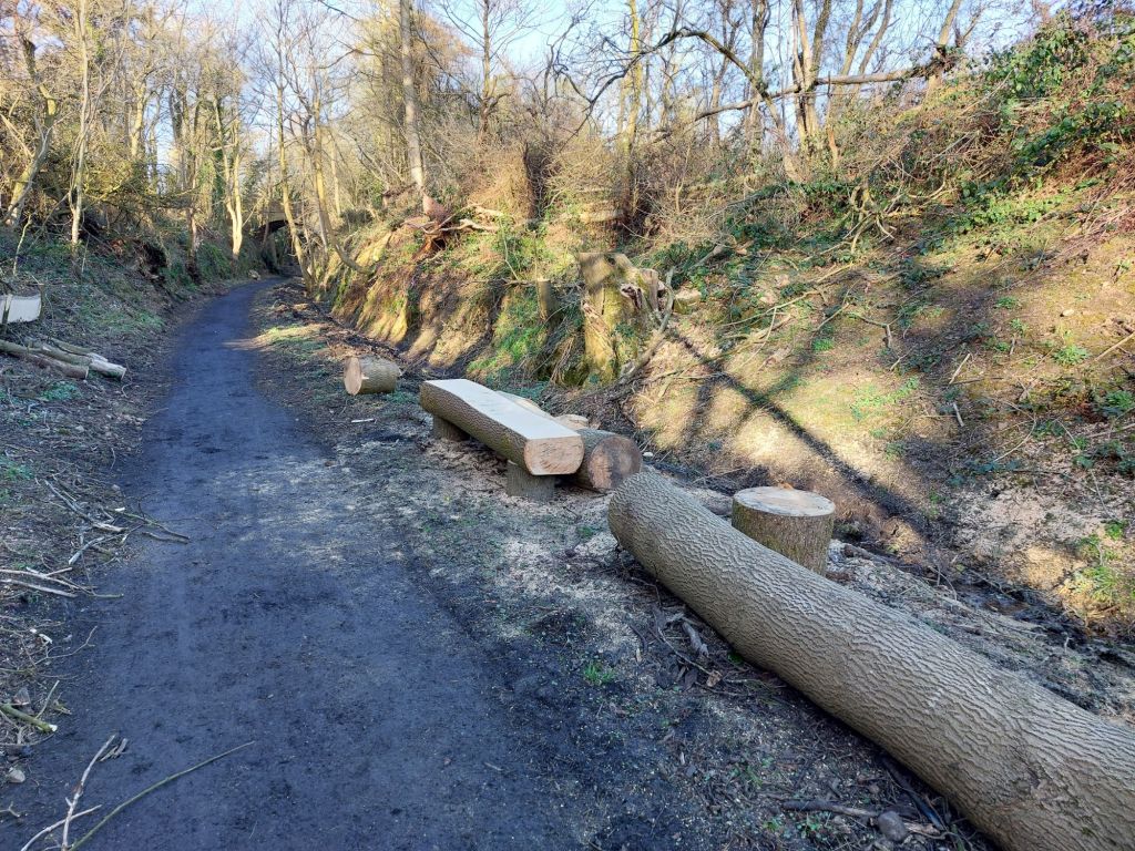
Approaching the Rugley Bridge through a deep, and quite damp cutting, we pass a large bench made from felled wood (this stretch was hard to pass due to swampy conditions and a number of trees fallen during Storm Arwen in November 2021, with windspeeds in the area reaching 98mph at nearby Brizlee Wood.

Location of Rugley Bridge
A handy place for a rest!

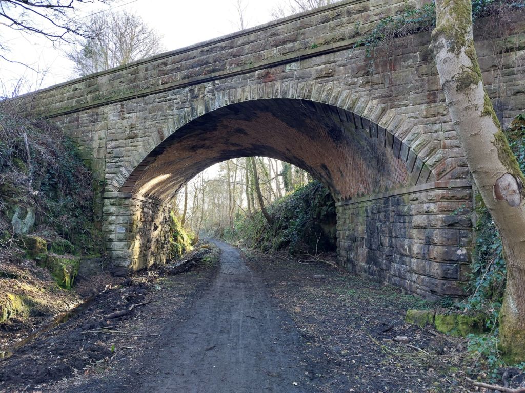
Rugley Bridge itself is a marvellous structure with beautiful brick and stonework; it was fairly recently threatened by National Highways to be competely infilled with concrete as the bridge at Great Musgrave controversially was.

Happily through being alerted by the HRE Group to this, and actions by many people this disasterous proposal was dropped and the bridge remained open, allowing this route to be opened in the last few days.

Beautiful skewed brickwork under Rugley Bridge
Need for good drainage along this section!

Beyond Rugley Bridge and to Bridge 2

Out onto another embankment and curving northward steadily, the path again opens up with some wonderful views! 

Back to embankment again after Rugley Bridge and the cutting.
Another change in the view, what a diverse route this is!
The second bridge to pass over on the Borderline Greenway.

Bridge 3

Another small bridge is crossed over here (no photo taken).

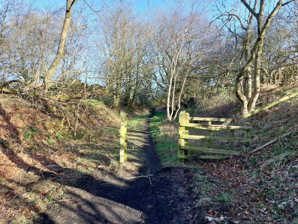
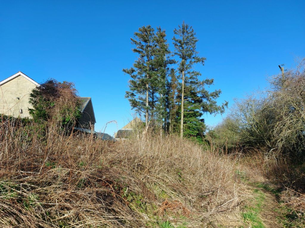
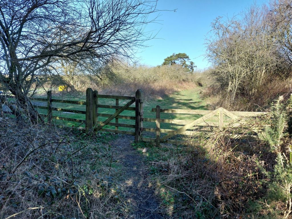
The end of the Borderline Greenway and beginning of the Freemen of Alnwick section (Freemen Gate 1)

As stated earlier, the route has two different custodians, the first section is the Borderline Greenway CIC, who have cleared the trackbed as far as the remains of this gate, with the Freemen of Alnwick the landowners beyond, with the trackbed in a more natural state.

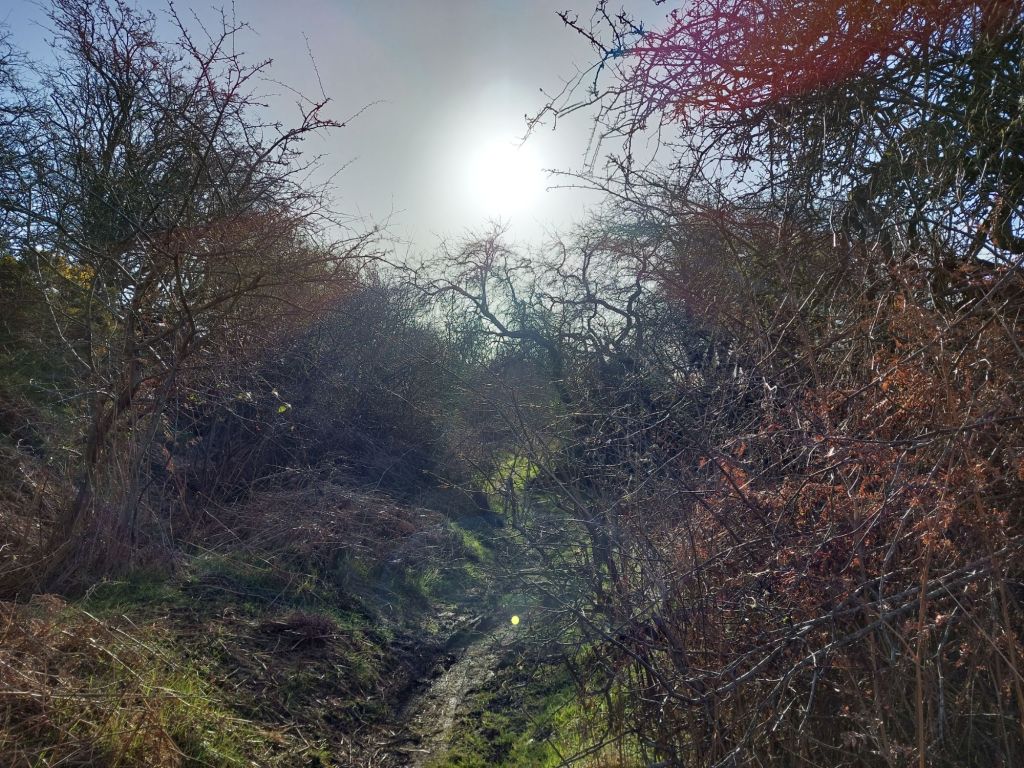
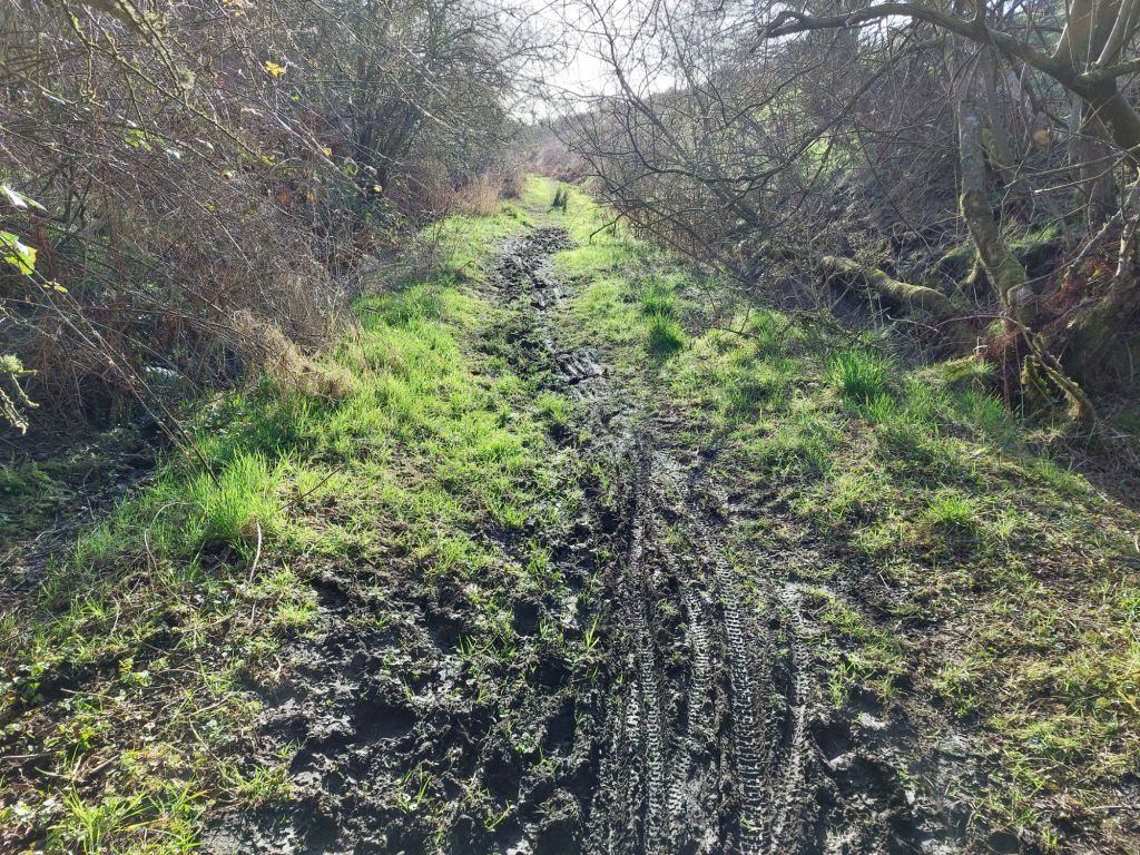
Beyond this point, it is slightly more challenging to pass due to overgrown bushes and trees, with some having fallen across the trackbed in places. The drainage on this section is also blocked, making some sections quite ‘clarty’, a good pair of boots is recommended!

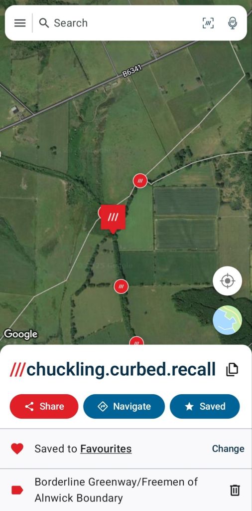
Remains of a gate mark the boundary between the Borderline Greenway and the Freemen of Alnwick section of the Alnwick & Cornhill Line
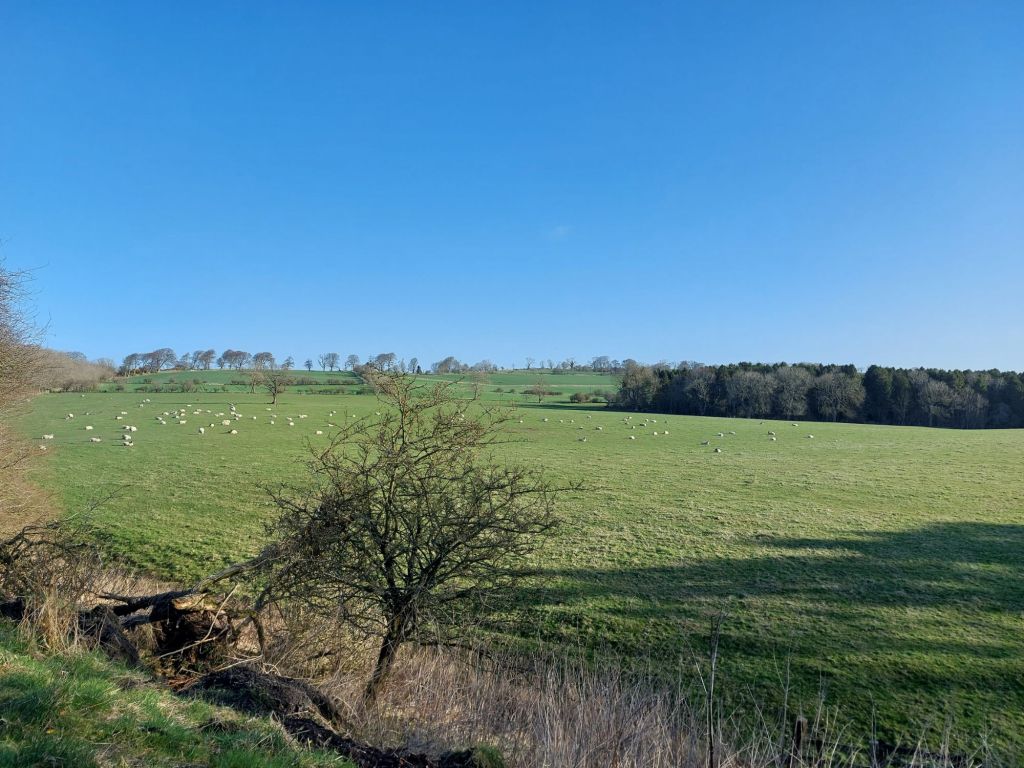
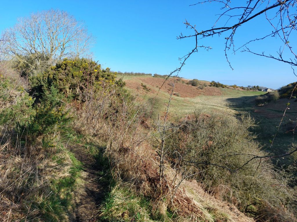
Spectacular views of the moors from the trackbed.
As can be seen, a much more natural path, with Gorse prevalent on this section.
Walking atop another large embankment
Pass through with care
A wild cutting
A clarty section
More clarts, but showing it is a well used path.

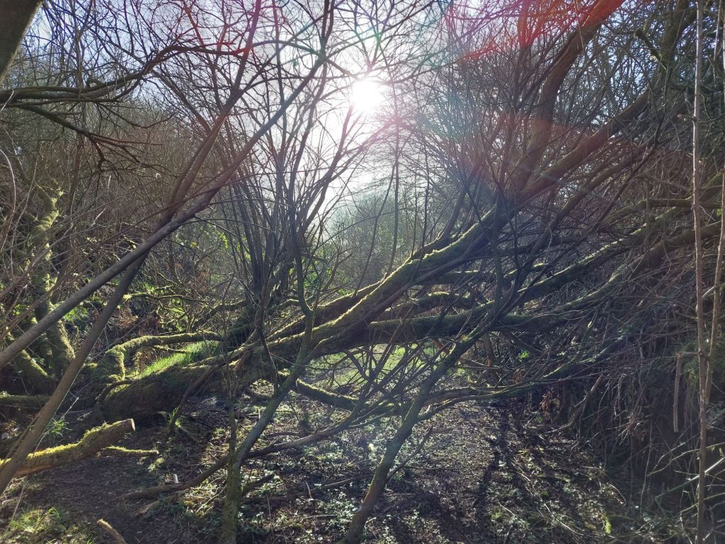
Fallen trees can be passed under
Or in this case over (to the left hand side)

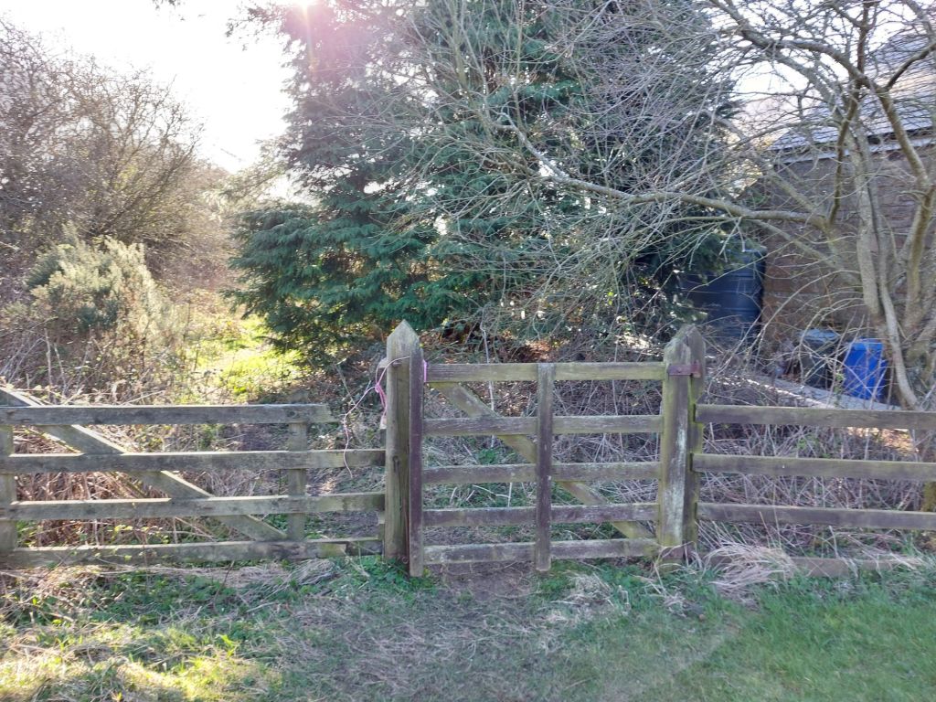
Freemen Gate 2

This section is almost at an end now, as we approach a minor road that connects to the B6341, passing through a small gate near a cottage.

Minor road adjacent to the cottage, with the route to the B6341 heading off to the right.

The B6341 Bridge and Route towards the Summit

Whilst not in the scope of todays walk, it appears possible to continue along the trackbed under the B6341, through another gate and on towards the Summit of the line beyond, the route from Alnwick having been a constant, steady uphill gradient.

This bridge, like the one at Rugley was under threat from infilling by National Highways, but hopefully the intention to see the full Alnwick and Cornhill route become an active travel corridor will see these bridges remain safe for years to come.

Bridge carrying the B6341 over the Alnwick and Cornhill Railway
Another good example of skewed brickwork on these bridges
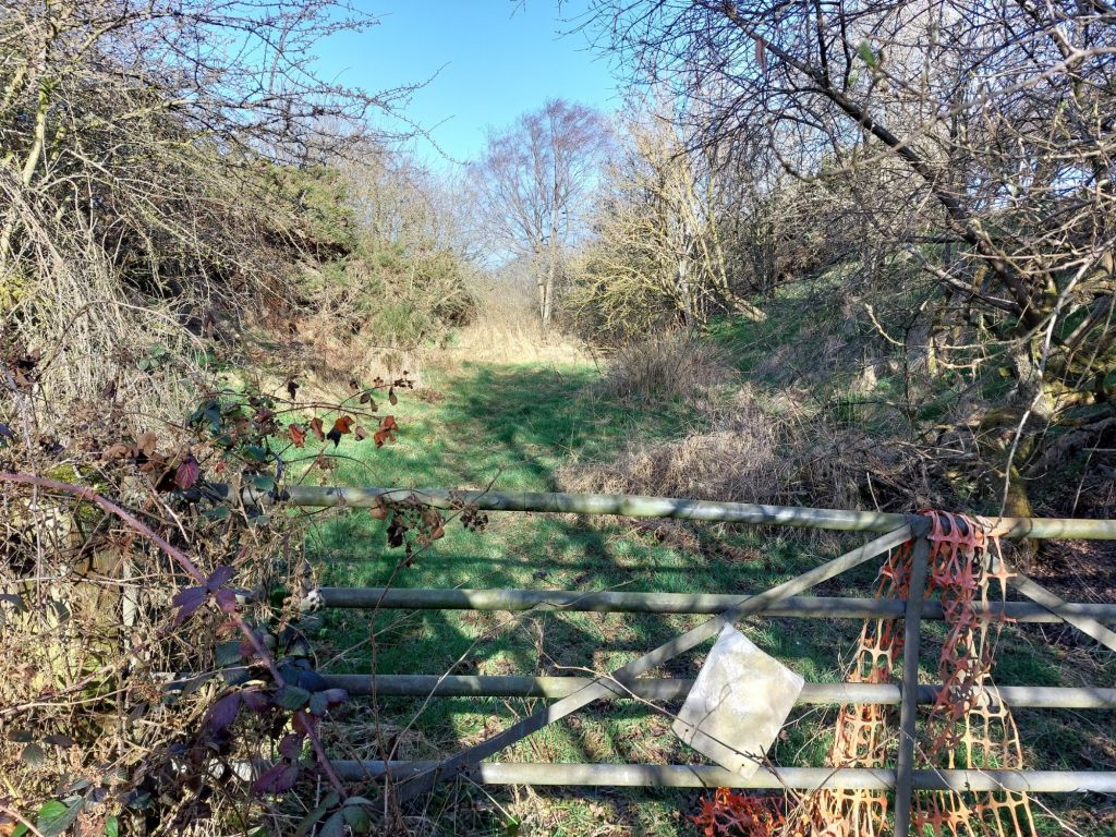
Another gate and the route towards Summit.
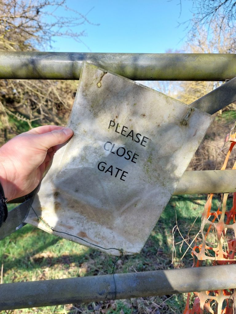
Please close the gate on this section
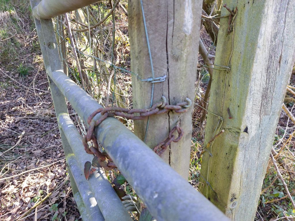
Simple chain to hold the gate closed.

This above route will be explored at a future date, for now, it is back under the bridge, and to walk the B6341 back to Alnwick.

Back to home Alnwick along the B6341

The above walk was a circular one from home, so it was a pleasant walk back along the B6341 on the final leg of the morning.

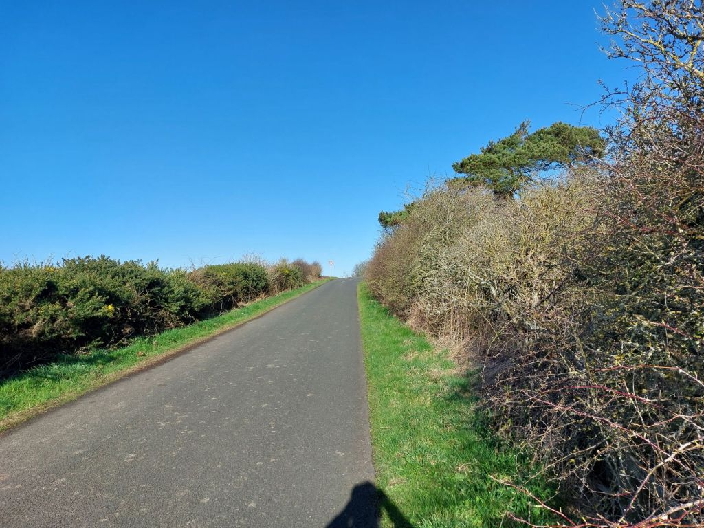
Heading from the cottage up to the B6341
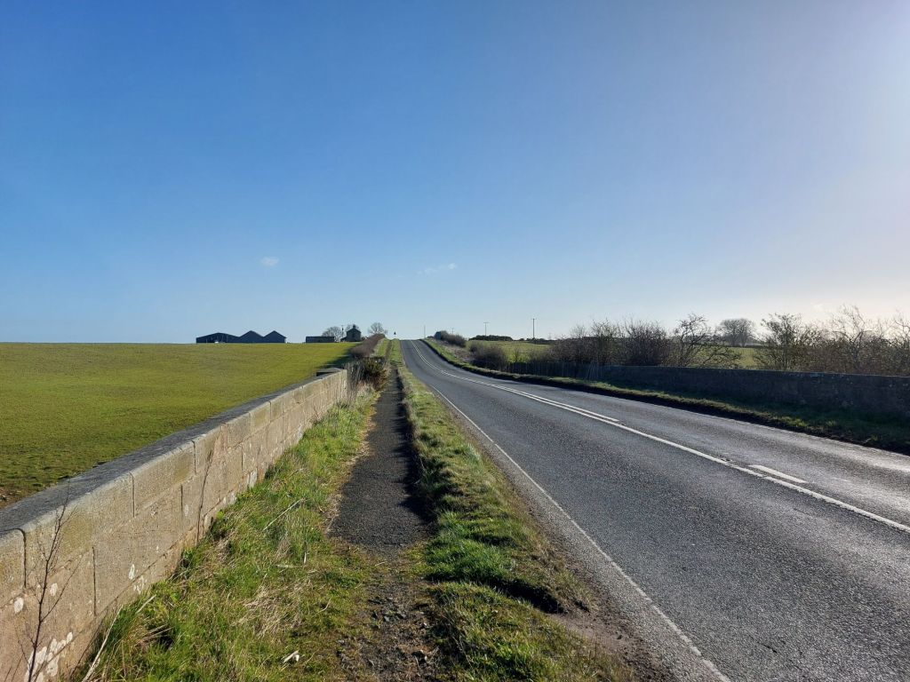
Top of the bridge heading back to Alnwick
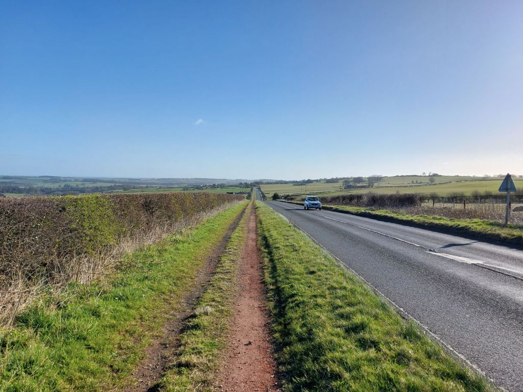
Over the hill on the Moor, heading toward Alnwick
No refreshments first thing on a Sunday morning, but maybe next time!

Seeing how this route develops in the coming months and years will be interesting, and that a walk or cycle the full length to Cornhill would be a fantastic trip!

Thanks for reading. If you’d like to assist me with the Northumberland Coast Loop, please visit  https://ko-fi.com/northumberlandcoastloop

Green Signals Podcast on the North Blyth – Fort William Alumina; can we see a North Blyth to the Border or Beyond Video?

In Episode 48 of the excellent Green Signals podcast, presenter Richard Bowker takes a trip with GBRf CEO John Smith on the North Blyth to Fort William alumina train (the ‘Alcan tanks’), starting at c.17:00 minutes into the above video, it showcases the route from Springburn, near Glasgow to Spean Bridge, near Fort William in Scotland, which is excellent to see and well worth a watch.

It would be good, if Green Signals is to have another ‘jolly’ on camera, to perhaps see the Northumberland end of this interesting freight route that would have a good overlap with the progressive opening of the Northumberland Line, and could showcase a route that this campaign is aiming to see become a reality.

Can Nigel, Richard, and Steff make it happen? Hopefully so!

Thanks for reading, RH.

Northumberland Line: Nearing Quarter of a Million Passenger Trips & Future Expansion Plans

News has just broken from The Chronicle that the Northumberland Line is expected to reach 250,000 trips by Easter 2025; mere months after opening in December 2025, and with only half of the stations opened.

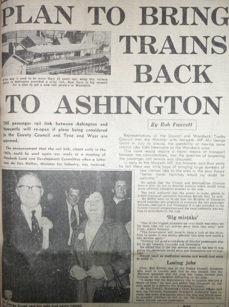
This is excellent news for the route, which has seen reopening campaigns since the mid 1970’s, with a meeting between the then MP for Morpeth, George Grant meeting with Eric Heffer MP, the then Minister for Industry.

Looking forward, it is a fairly safe assumption that the Northumberland Line may see 500,000 passengers by the first anniversary of the line reopening to passengers in December 2025.

It also lends a strong case to expansion of the route; with several possibilities available, but two within easy reach could use existing track and stations to provide a expanded service.

Newcastle – Morpeth – Bedlington

This route has long been argued for, and was at one time seen as a way to initiate the return of services to Bedlington as a first phase of reopening.

It is now understood to be in the works for starting once Bedlington station is completed, allowing units currently idle at Coopies Lane sidings to run to Bedlington and back, giving an east-west connection.

Hopefully with Bedlington station due to complete by December 2025, this service may be introduced alongside?

Newcastle – Bedlington – Pegswood – Berwick – Edinburgh

This campaign was established to combat the potential oversight of this route by other campaigns.

It is very much an ‘train ready route’, as it was used earlier this month for the SRPS ‘The Seven Counties Rambler’ railtour to offer a through north-south link between Newcastle and Edinburgh via Bedlington.

If the Newcastle, Morpeth, and Bedlington route is ready to go, this one should also be a quick one to implement too. 

This route would offer a few key advantages;

  • Additional trains alongside the Northumberland Line service would offer additional seating capacity, which is a known problem on the line given its popularity and would offer a potentially quick fix to this.
  • Would avoid passengers bound for North Northumberland/Scotland needing to travel south to Newcastle to make onward connections, and taking up capacity in that direction, and instead would board direct trains headed northwards, or on return, would vacate seats at station such as Blyth Bebside to be occupied by other passengers heading into Newcastle or beyond.
  • Builds on the proposed use of Morpeth – Bedlington services to support the proposed new station at Choppington, and would only require the short chord from Hepscott Junction to Morpeth North Junction to enable this route, with Hepscott Junction to Bedlington Junction being shared with other passenger services.

If you’d like to support this route, please sign the petition here.

Other extensions

This campaign supports all other extensions to the Northumberland Line such as that to Newbiggin by the Sea, which are campaigned for elsewhere.

Call to Kim McGuinness: Invest in the ECML and N.C.L. in Northumberland, and drop dualling the A1.

There has been a recent, and largely very welcome announcement in recent days about a £208m transport investment, part of a larger overall ‘£8.3bn transport vision’ which includes welcome schemes such as reopening of the Leamside Line, integrated ticketing, and wider public transport and active travel improvements.

That being said, dualling the A1 has once again reappeared, and given its £500m+ price tag would still constitute a sizeable chunk of the overall vision.

This latter scheme is undesirable for a number of reasons covered a lot of times before, but will be briefly reiterated here for clarity:

Dualling the A1 is poor value for money and bad for the environment, with little impact on safety.

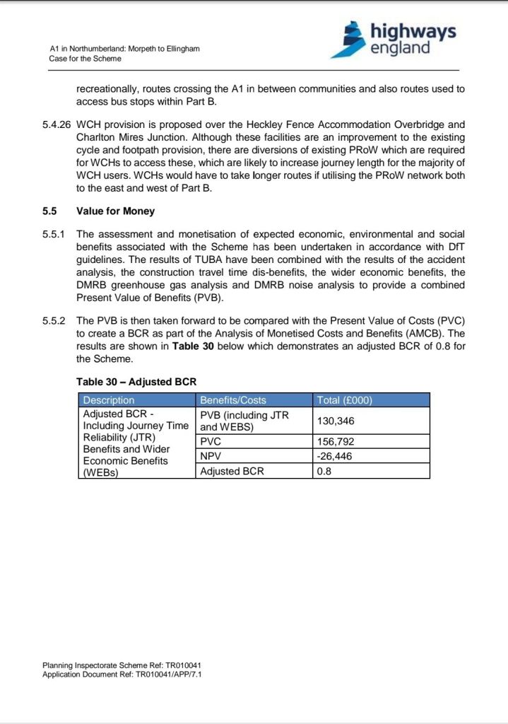
Regardless of price, dualling the A1 has a benefit:cost ratio of just 0.8, meaning for every £1 in, only 80p of economic benefit would be returned. With a £500m+ price tag, this means an economic loss of £100m or more, which even in the best economic situation makes little sense, but with the huge pressure on the public purse, it makes zero sense now.

Dualling the A1 is poor value for money, as stated clearly in this document, sourced by TAN

It is also negative on environmental grounds

The case against dualling doesn’t end at just being poor value for money, it also has adverse impacts on a large amount of ancient woodland, especially in and around the Coquet valley, as well as being responsible for 2,487,000 tonnes of CO² over its lifetime (build plus traffic, which is still significantly reliant upon petrol & diesel vehicles), a do-nothing scenario would result in lower emissions, especially if coupled with modal shift away from driving (which this campaign advocates for), and a do-nothing would also protect habitats such as ancient woodland, alongside allowing the £500m+ of financing to be allocated elsewhere.

Dualling is not a major safety fix

While it may be true that a dual carriageway may have some safety gains, it is far from making a road totally ‘safe’, as sadly borne out by fatal and serious accidents on already dualled sections of the A1 itself, as well as on similar roads elsewhere in the UK.

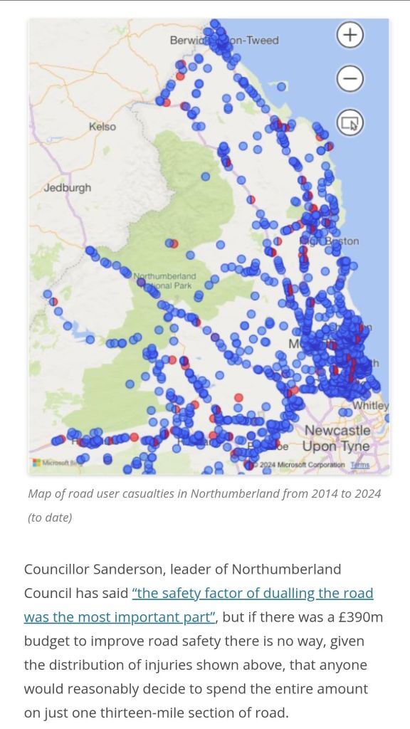
Part of the analysis by Space4Gosforth highlights this problem well, with a decade of accident data shown below.

Spending £500m+ on one thirteen-mile stretch of road could surely be better allocated to reducing road casualties across Northumberland as a whole. Accident rates on dual and single carriageway sections were so similar as to not represent any real difference; so in safety terms, the argument for dualling is a false one.

In the time period between 2014 and 2024, 141 lives were lost on Northumberland roads, and 1,550 serious injuries; inducing more road traffic will only make these figures worse, and the number is far too high a toll already.

Invest in the ECML & N.C.L. instead?

People still need to travel, and if not by road, they need a viable alternative to do so.

For the A1 in particular, especially the stretch between Morpeth and Berwick, the East Coast Main Line (ECML) runs in near parallel throughout, and represents where an alternative investment might be better placed.

As stated on the Railfuture North East webpage, a study into a local (all stations rail service) between Newcastle and Berwick was carried out as recently as 2019, and found to be economically viable (i.e. benefit:cost ratio greater than 1:1), this would represent an excellent scheme for Kim McGuinness to implement rather than the deeply flawed dualling of the A1.

Consider the Northumberland Coast Loop too.

Alongside improving the ECML rail service as above, the Northumberland Coast Loop could also be considered. This route would offer a new rail route between Newcastle and Berwick or Edinburgh going via Bedlington, and Pegswood.

Route map of the Northumberland Coast Loop
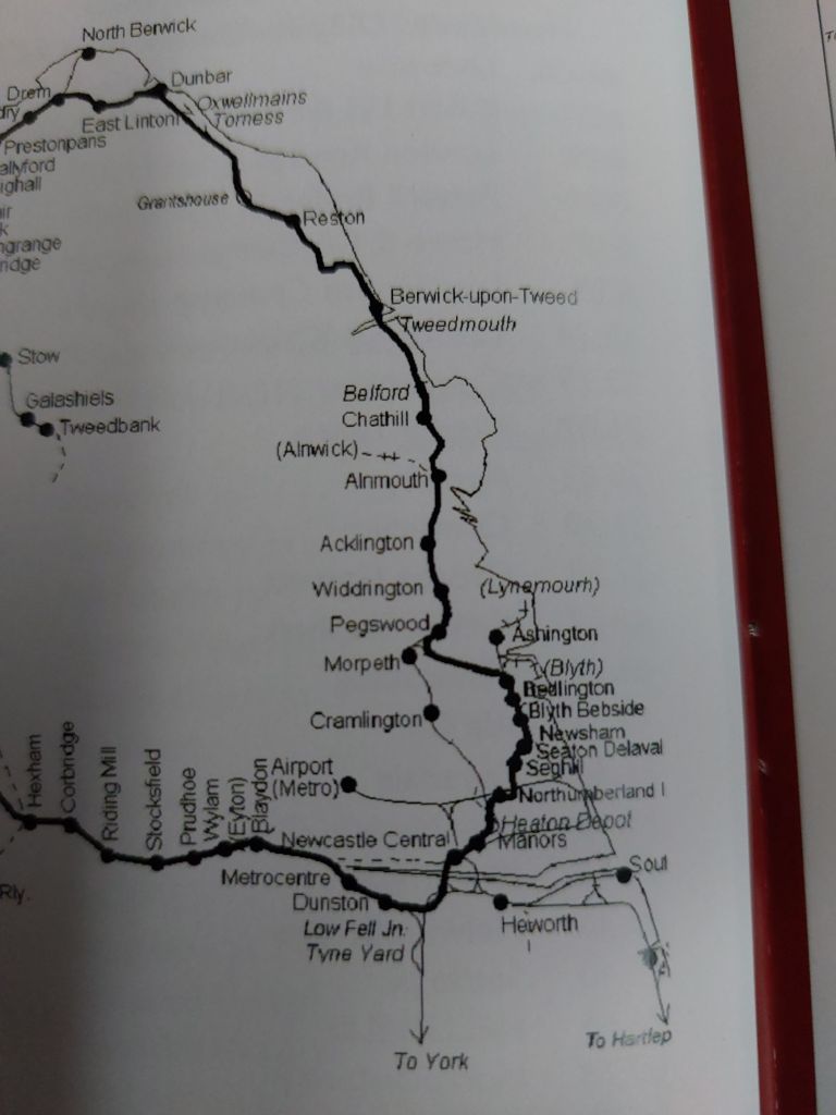
Rail map of ‘The Seven Counties Rambler’, operated by the SRPS that took the N.C.L. route on 8th March 2025.

As can be seen from the above maps, a rail service via the Northumberland Line as far as Bedlington, then cutting across west to Pegswood is already possible on existing track, and was traversed by the SRPS operated ‘The Seven Counties Rambler’ on the 8th March 2025.

The Northumberland Line, on the day of opening Newsham station, was revealed to have carried over 135,000 passengers, despite being open for less than 100 days and with only two stations open between 15th December 2024 and Monday 17th March 2025 (opening day for Newsham station).

Running through trains from Newcastle to Edinburgh via Bedlington (or vice versa), would give this area a new northbound service that would very much compliment the existing and already popular Northumberland Line service between Ashington and Newcastle.

A previous petition for the route obtained a total of 742 signatures, with a current one, that is still ongoing and aiming for the aforementioned Newcastle – Bedlington – Edinburgh rail service performing strongly.

With an overall cost of £298.5m, the Northumberland Line, 18 miles in length gives a very approximate cost per mile of £16.6m per mile.

For the Bedlington to Pegswood link, about 6 miles between stations, a similar cost per mile would mean such a link would be in the ballpark of £99.6m, but that would likely include station costs of the proposed Choppington station as the Northumberland Line figure is counted as an ‘all in’ scheme and not trackwork separate to stations, and it may even be possible to build a station on the Morpeth North Curve where this line joins the ECML to allow Morpeth to be served by trains on this route.

Taking this near £100m figure as a baseline, it can be seen that this is a mere fraction of A1 dualling costs, and if £500m+ is available for the corridor, would mean £400m+ would also be available for the ECML between Morpeth and Berwick?

Similarly, a popular proposal that would complement the wider bettering of public transport is for a dedicated ‘Bus Meets Train shuttle between Alnwick, Alnmouth Station, Warkworth, and Amble, with a petition for this again performing very strongly to date, despite only recently being launched. Again this bus service would cost a mere fraction of that proposed to be spent on dualling the A1 in Northumberland, but would give potentially greater economic and certain environmental benefits to the popular tourist towns of Alnwick, Warkworth, and Amble.

We would implore Kim McGuinness, as North East Mayor to reconsider dualling the A1, and instead invest the funds into the ECML and N.C.L. rail routes.

Achtung! Achtung! Walking the Northumberland Coast Loop: Morpeth Railway Station to Morpeth North Junction

To borrow the phrase often used on the ‘We have ways of making you talk’ a WW2 podcast by comedian Al Murray and historian James Holland, let us ‘walk the ground’ of Northumberland Coast Loop for the short section between Pegswood and Bedlington that, so far, is not used regularly for passenger trains.

This route does require walking on uneven ground such as field edges and over some gentle gradients, so might not be suitable for all, please make a judgement on your own capabilities before undertaking this walk. Sturdy boots are a recommendation. 

SAFETY MESSAGE

STAY OFF THE RAILWAY, THIS WALKING ROUTE IS USING BRIDGES/LEVEL CROSSINGS TO EXPLAIN THE ROUTE AND WHERE IT CAN BE VIEWED FROM SAFELY. NEVER WALK ON RAILWAYS.

Morpeth Railway Station to Morpeth North Junction

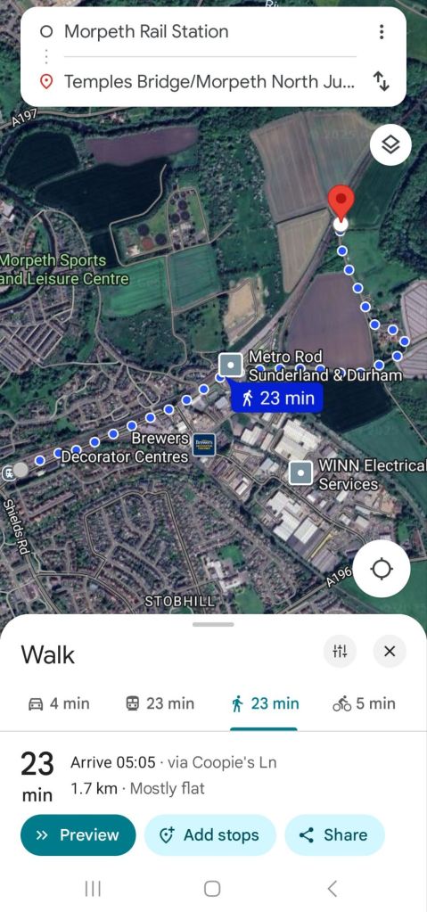
To reach Morpeth North Junction, starting from Morpeth Railway Station is a very simple short walk almost parallel to the East Coast Main Line. The end destination is ‘Temples Bridge’ that carries a small farm track over the East Coast Main Line (ECML), from which is it is possible to view Morpeth North Junction.

If arriving by car, I would recommend parking in the station car parks, but if you do choose to park elsewhere, please do so considerately.

What3Words address of Morpeth North Junction

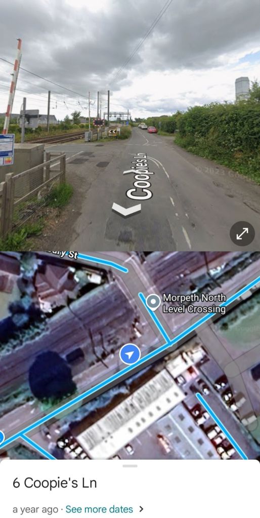
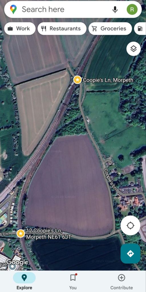
To reach it from Morpeth Station, exit the station onto Coopie’s Lane and turn left, heading approximately north east, parallel to the east coast mainline. This will take you over the level crossing at Coopies Lane (the line here heading towards Bedlington from Morpeth station). The railway junction at Morpeth station is simply called ‘Morpeth Junction’, but we are headed north to ‘Morpeth North Junction’, around a 23min walk away. Please note it is not possible to drive to this bridge over the ECML. While you may be able to park closer, please observe that access needs to be maintained to businesses, farms, and residences and so please park considerately if doing so.

Coopies Lane Level Crossing

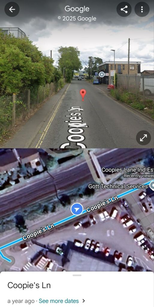
Continue along Coopie’s Lane past the footpbridge over the ECML and the premises of Gott Technical Services, where you’ll need to cross the road as the footpath on the left hand side ends where it heads onto the footbridge, but continue to walk in parallel to the ECML.

Gott Technical Services and Morpeth railway footbridge

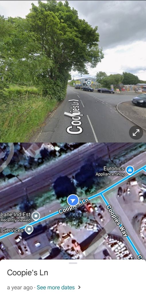
Next, you’ll approach a road junction, where Coopie’s Lane continues straight ahead, with Coopie’s Way diverging to the right, stay straight ahead and remain on Coopie’s Lane and parallel to the ECML.

Keep walking along Coopie’s Lane, and you’ll reach Morpeth North level crossing over the ECML on your left, here you need to bear to your right (headed towards the red car in the image below), remaining on Coopie’s Lane.

Remain on the south side of the ECML and on Coopie’s Lane
Continue to follow the road, and whilst quiet, this road had no footpath along it so please be cautious for traffic.

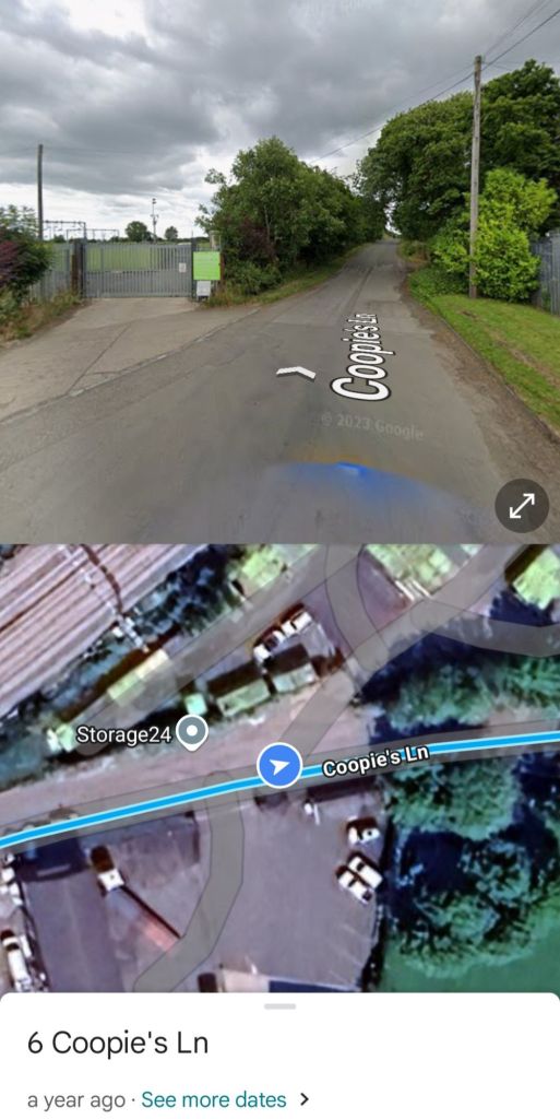
Next up is Storage24 on the left, Coopie’s Lane continues to the right of this site and begins its first climb as it heads over the Morpeth North Curve.

Storage24 and approaching Morpeth North Curve

Morpeth North Curve

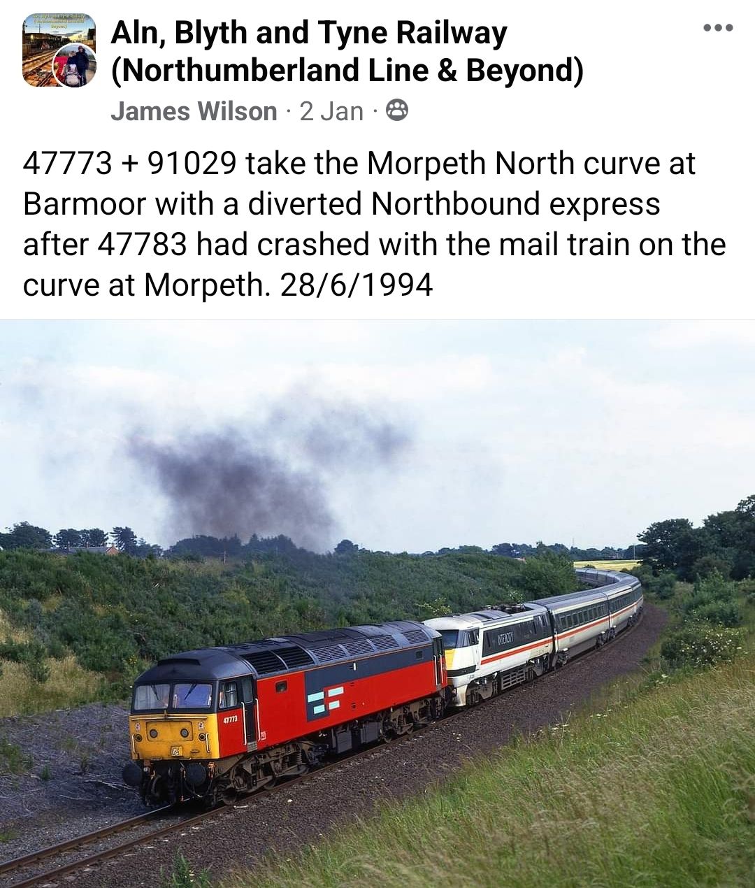
Here we finally encounter the Morpeth North Curve, built as recently as 1980 (still very new in railway terms), which gives the direct northbound link from Bedlington onto the ECML. Today, this is mostly used by the North Blyth to Fort William ‘Alcan’ service a handful of times per week, but once was a busy route for coal traffic, as well as seeing a number of diversions around Morpeth due to rail accidents there.

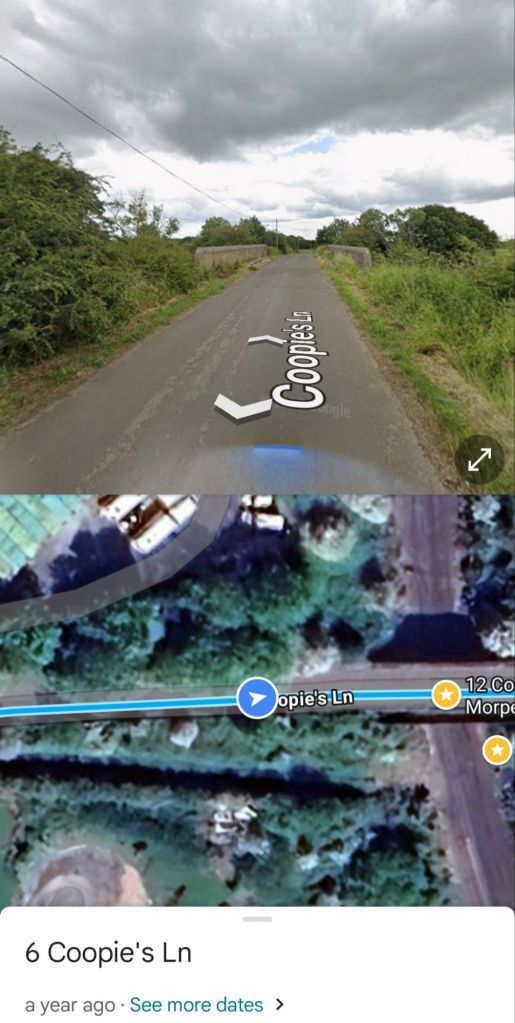
Bridge over the Morpeth North Curve
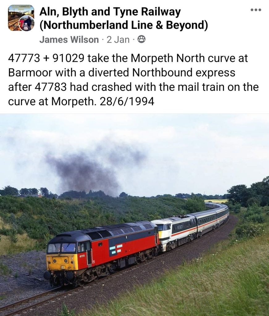
Example of a diversion in 1994 using the Morpeth North Curve following a rail accident. Photo by James Wilson

Electric Future?

The above image showing a 91029 being dragged by 47773 shows the value in electrification of this line would have, as with an increasingly electric railway, overhead wires would allow electric trains to be driven over the route, rather than dragged along it. Bi-modes could do the job in the short term, but wiring, at 25kV AC is the long term future for most railways and the N.C.L. route could almost certainly justify electrification.

Towards Temples Bridge

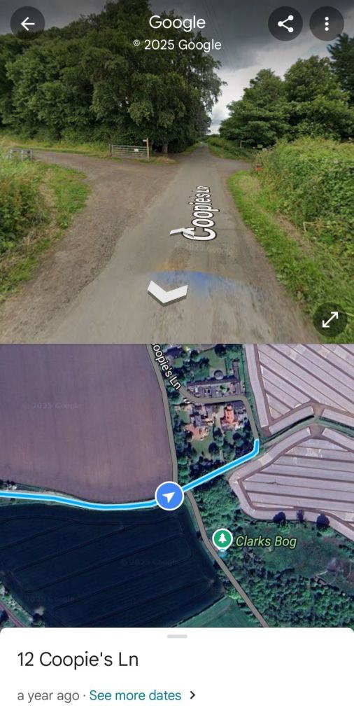
Continue walking along Coopie’s Lane until reaching a crossroads of sorts where a few houses are dotted around. If you do take a vehicle along the route, this is about as far as you can reach by car.

The route you now need take is on your left, entering the field and following the footpath close to the hedgerow, taking you on the path to the west of the houses (the road is private shortly beyond this crossroads, and where Google maps’ Streetview ends).

The two bridges over the railway, the first near Storage24 (bottom left), and Temples Bridge (top centre).

Simply follow the footpath almost due north , until you reach Temples Bridge, from there, you can clearly see Morpeth North Junction where the line to Bedlington from Pegswood and the north diverges from the ECML heading eastwards, ultimately joining the Northumberland Line at Bedlington Junction.

To return to Morpeth Station, simply retrace your steps back.

If you do take this quite nice short walk, please let us know via our social media and maybe share your photos/videos too!

The N.C.L. an option to alleviate Northumberland Line overloading?

It is great to see that the first 100 days of the Northumberland Line (Sunday 15th December 2024 to Monday 24th March 2025), the recently reopened route is an undoubted success. 

On the flip side of this, some trains are proving so popular that at peak times there are not enough trains to satisfy demand; resulting in passengers being turned away at some stations. Which is not what anyone wants to see. 

Shortage of Northern Units

Reasons for this crowdingis due to some the services being formed of 2-car trains, not as 4-car ones that stations are able to fit, meaning that the number of seats/standing places is limited.

This is apparently due to a shortage of rolling stock (multiple units) at Northern, with apparently no easy answers for how Northern might run four car trains between Ashington and Newcastle, without reducing services elsewhere.

This needs a quick solution, as Newsham station, the third of the six to open just a week ago, has proven highly popular and will add to the crowding of services at peak times, let alone once Bedlington, Blyth Bebside and Northumberland Park become completed.

Solution: Use Other Operators?

One solution, particularly at a weekend when fewer scheduled services are running might be to employ other diesel or bi-mode fleets on a Newcastle – Bedlington – Pegswood – Edinburgh route (and vice versa).

Suggested stops at Blyth Bebside and Northumberland Park on a new Newcastle – Edinburgh service, but Newsham/Seaton Delaval could do for now?

An example suggested some time ago on this blog was to use Transpennine Express* Class 80x bi-modes (diesel & electric) over this route; it would still offer a good overall Newcastle to Edinburgh journey time (a bit slower than via Cramlington, but still good enough, and could be compensated by a reduced fare) whilst boosting capacity on the Northumberland Line and giving a northbound connection to boot.

*other operators such as CrossCountry/LNER etc could also be considered.

Charter trains could be a further option to provide additional capacity in the short-term too.

In short, it gives the following advantages;

  • Quick implementation as the route and rolling stock already exists.
  • Alleviates the crowding issues seen on the newly opened Northumberland Line.
  • Gives SE Northumberland the opportunity for northbound connections into North Northumberland and Scotland.
  • Gives more network resilience as train drivers and crew would be familiar with the ‘B&T diversionary route’, especially given the issues with Plessey Viaduct in 2023 which highlighted the routes potential for diversionary use, as has been done in past decades.

I would like to see this option considered by Northumberland County Council, Northern etc as a way to tackle the problems of crowding on the Northumberland Line.

If it is possible, please just do it. If not, please explain why it can’t be done.

RH.

N.C.L. News: Newcastle, Bedlington & Edinburgh Rail Link, plus the Alnwick to Amble Bus Meets Train Campaign.

Newcastle – Bedlington – Edinburgh Rail Service Campaign

As of 21.3.25, the petition for the Northumberland Coast Loop route to Edinburgh from Newcastle (Newcastle – Bedlington – Pegswood – Berwick – Edinburgh) is performing well with 237 verified signatures

It has also now got a much easier link to view and sign it at  https://www.change.org/northumberlandcoastloopedinburgh

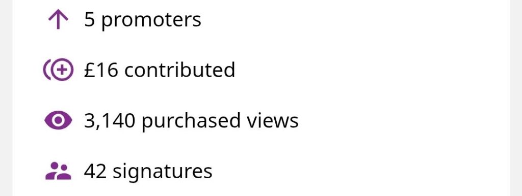
Massive thanks to those who have financially supported the rail petition!

Massive thanks to all contributors to the rail petition, with every donation, large or small going directly to change.org to help promote the petition for a rail service from Newcastle to Edinburgh via Bedlington; this route being used as recently as the 8th March 2025 with ‘The Seven Counties Rambler’ railtour passing over it.

Let’s hope that other local rail campaigners will get behind this proposal, as they are already aware of it. 

Alnwick, Alnmouth Station, & Amble ‘Bus Meets Train’ Campaign

Complementing the above rail service proposal, is one for a dedicated bus service to improve connection between the Northumberland towns of Alnwick, Amble and Warkworth to Alnmouth railway station.

It was launched in response to recent comments made on the Alnwick Matters Facebook Group that buses to and from Alnmouth Station were not adequate and needed improvement, and is borne out by the strong support for the petition.

Alnwick Castle in particular has been mentioned by train ticketing company TrainSplit as being within easy reach of Alnmouth Station by bus.

The proposal centres around providing a half-hourly bus service from the railway station to both of these towns, which is presently poorly served by other bus services, which run on an inconvenient schedule, and have a reputation for unreliability, being either late or not running at all.

This would support a better connection to all rail services, not just those proposed for the Northumberland Coast Loop.

A dedicated bus could overcome the unreliability of existing bus services, as well as making a much improved ‘bus meets train’ service connecting this popular area of Northumberland with local and national rail services.

The petition is performing well, having just exceeded 300 signatures, and now also has a bespoke link to it here: https://www.change.org/AlnwickAlnmouthAmbleBusMeetsTrainCampaign

Yet again, I would like to thank all the supporters of this campaign, who have given an amazing £44 via Change.org to help promote the petition.

In total, this represents a fantastic £60 of support via change.org to help promote these petitions, and a total of 540 signatures across both petitions.

Thank you to everyone who has made a contribution of any size, even those simply sharing these petitions with friends and family is of huge benefit at zero cost, and please help keep up the momentum!

Thank you, and kind regards, Ryan Hogg.

An Ode to the Northumberland Coast Loop

Toon to Berwick a service by rail,

Hugging the beautiful coast, in hand spade and pail,

Starting from the mighty Tyne,

And crossing over the tiny Lyne,

Passing places like Seaton Delaval Hall,

It is a route that has it all,

To the reach and cross formidable Tweed,

For this rail link, there is a need.


From Hadrians Wall to the Scottish Border,

This is a land once of the fierce marauder,

The stories of Lindisfarne and the violent Viking,

Now is a place of peace, quiet and people biking,

This route up the Northumberland’s east,

Is home to the Laidly Worm, a terrible beast,

While princesses may quake with fear,

There are plenty of brave knights near.


An opportunity to leave your car at home,

Leave it beside your garden gnome,

Instead go to the station, catch the train,

No hassle of traffic, no driving pain,

Train and bus to go to Amble,

An ideal place for a coastal ramble.

To Bamburgh for the castle on a hill,

Or just out for ice-cream and a chill.


From urban Blyth it’ll take you away,

To somewhere north to lounge and play.

Alnwick has plenty to see,

From lush but poisonous gardens to Grannies for tea,

A castle home to Duchesses and Dukes,

Or to go to the old station to Barter your Books,

Spend a day under a beautiful sky,

Maybe enjoy a delicious Turnbull’s pie?


So haway fella and alreet hen,

Can I ask you to get oot your pen,

To give our petition a sign,

Just below, pop your signature on, and bring about the above rail line?


👉 PUSH THIS LINK FOR THE PETITION 👈

Thanks, RH.