
A very kindly shared route map from Paul (‘@lf_p’ on Twitter/X), this is a visualisation of a ‘Route Map’ across the North East, ranging from Berwick upon Tweed in the north, down to Horden, and Durham in the south, with Haltwhistle in the west.
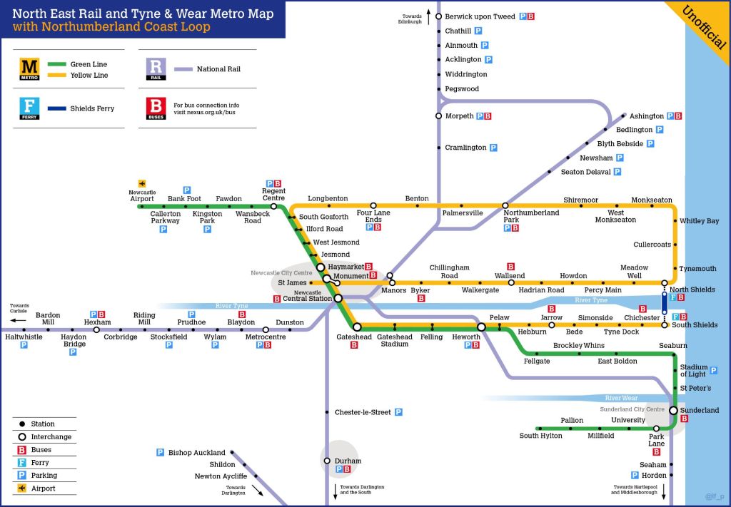
As can be seen from the map above, the proposed Northumberland Coast Loop would leave Central Station and follow the route of the Northumberland Line as far as Bedlington, and in this diagram, would curve back towards the East Coast Main Line (ECML), using the existing line through the village of Hepscott, used predominantly by the GBRf ‘Alcan’ flow from North Blyth to Fort William.
At the triangular junction near Morpeth, the N.C.L. would take the upper curve (the Morpeth North Curve) towards Pegswood, the route then running north towards Berwick Upon Tweed and ultimately Edinburgh, again this route is used regularly for the North Blyth to Fort William railfreight, but sadly little else by way of rail traffic on a regular basis, for the time being?
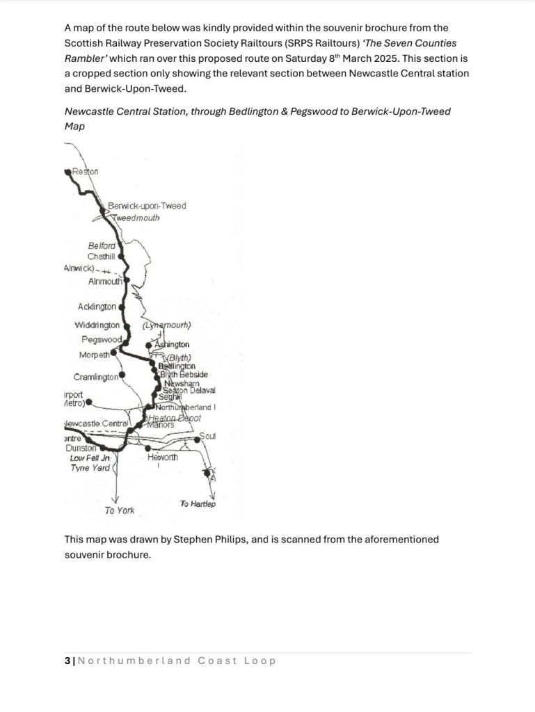
The map above from the SRPS is a more ‘true to geography’ map compared to the above route diagram (in a T&W Metro style), but the Metro style map perhaps shows the layout of lines more clearly, and illustrates why Morpeth and Ashington can’t be directly served by the proposed Northumberland Coast Loop route.
Hopefully these maps make the proposed Northumberland Coast Loop proposal easier to understand.
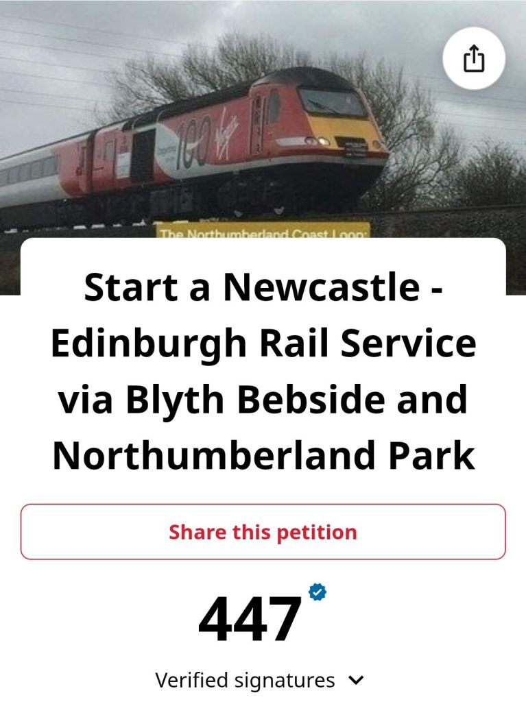
The petition for this route is continuing to perform strongly, and if you’d like to see it implemented, please sign it here: https://chng.it/J8DxHqpWdf
Thanks again to Paul for providing the above image, it is very much appreciated!
